You are here: Home > Network List > CI - Caltech Regional Seismic Network Stations List
> Station MPM Manuel Prospect Mine, California, USA > Earthquake Result Viewer
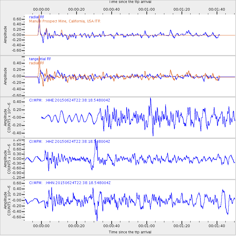
MPM Manuel Prospect Mine, California, USA - Earthquake Result Viewer
*The percent match for this event was below the threshold and hence no stack was calculated.
| Earthquake location: |
Southern Alaska |
| Earthquake latitude/longitude: |
61.7/-152.0 |
| Earthquake time(UTC): |
2015/06/24 (175) 22:32:20 GMT |
| Earthquake Depth: |
105 km |
| Earthquake Magnitude: |
5.7 MB, 6.2 MB |
| Earthquake Catalog/Contributor: |
NEIC PDE/NEIC ALERT |
|
| Network: |
CI Caltech Regional Seismic Network |
| Station: |
MPM Manuel Prospect Mine, California, USA |
| Lat/Lon: |
36.06 N/117.49 W |
| Elevation: |
185 m |
|
| Distance: |
33.6 deg |
| Az: |
123.881 deg |
| Baz: |
330.811 deg |
| Ray Param: |
$rayparam |
*The percent match for this event was below the threshold and hence was not used in the summary stack. |
|
| Radial Match: |
80.88116 % |
| Radial Bump: |
400 |
| Transverse Match: |
67.45411 % |
| Transverse Bump: |
400 |
| SOD ConfigId: |
7422571 |
| Insert Time: |
2019-04-19 11:17:46.063 +0000 |
| GWidth: |
2.5 |
| Max Bumps: |
400 |
| Tol: |
0.001 |
|
Signal To Noise
| Channel | StoN | STA | LTA |
| CI:MPM: :HHZ:20150624T22:38:18.548004Z | 3.9985716 | 2.7235163E-7 | 6.811223E-8 |
| CI:MPM: :HHN:20150624T22:38:18.548004Z | 2.998594 | 1.4043617E-7 | 4.6834003E-8 |
| CI:MPM: :HHE:20150624T22:38:18.548004Z | 1.7453693 | 1.3254176E-7 | 7.5939084E-8 |
| Arrivals |
| Ps | |
| PpPs | |
| PsPs/PpSs | |


