You are here: Home > Network List > CI - Caltech Regional Seismic Network Stations List
> Station SBC Santa Barbara, Santa Barbara, CA, USA > Earthquake Result Viewer
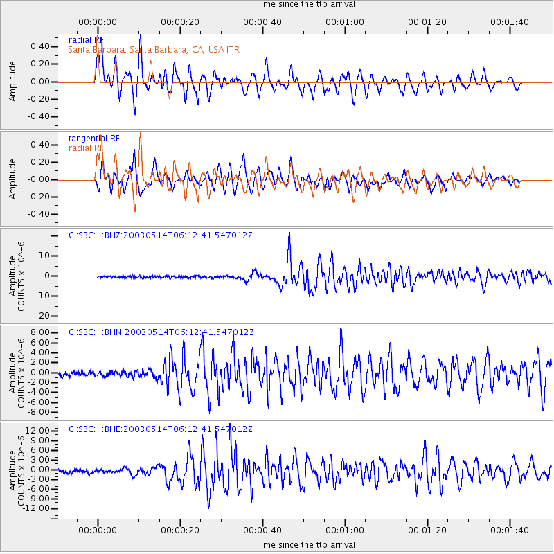
SBC Santa Barbara, Santa Barbara, CA, USA - Earthquake Result Viewer

| Earthquake location: |
North Atlantic Ocean |
| Earthquake latitude/longitude: |
18.3/-58.6 |
| Earthquake time(UTC): |
2003/05/14 (134) 06:03:35 GMT |
| Earthquake Depth: |
42 km |
| Earthquake Magnitude: |
6.5 MB, 6.5 MS, 6.6 MW, 6.6 MW |
| Earthquake Catalog/Contributor: |
WHDF/NEIC |
|
| Network: |
CI Caltech Regional Seismic Network |
| Station: |
SBC Santa Barbara, Santa Barbara, CA, USA |
| Lat/Lon: |
34.44 N/119.71 W |
| Elevation: |
94 m |
|
| Distance: |
56.3 deg |
| Az: |
299.569 deg |
| Baz: |
90.083 deg |
| Ray Param: |
0.06415785 |
| Estimated Moho Depth: |
10.75 km |
| Estimated Crust Vp/Vs: |
1.60 |
| Assumed Crust Vp: |
6.1 km/s |
| Estimated Crust Vs: |
3.812 km/s |
| Estimated Crust Poisson's Ratio: |
0.18 |
|
| Radial Match: |
85.68455 % |
| Radial Bump: |
400 |
| Transverse Match: |
87.45098 % |
| Transverse Bump: |
400 |
| SOD ConfigId: |
3770 |
| Insert Time: |
2010-02-25 21:34:42.373 +0000 |
| GWidth: |
2.5 |
| Max Bumps: |
400 |
| Tol: |
0.001 |
|
Signal To Noise
| Channel | StoN | STA | LTA |
| CI:SBC: :BHN:20030514T06:12:41.547012Z | 0.896812 | 3.8910403E-7 | 4.3387467E-7 |
| CI:SBC: :BHE:20030514T06:12:41.547012Z | 0.7364127 | 3.1336222E-7 | 4.255253E-7 |
| CI:SBC: :BHZ:20030514T06:12:41.547012Z | 1.2074614 | 4.0745164E-7 | 3.3744485E-7 |
| Arrivals |
| Ps | 1.1 SECOND |
| PpPs | 4.4 SECOND |
| PsPs/PpSs | 5.5 SECOND |


