You are here: Home > Network List > TA - USArray Transportable Network (new EarthScope stations) Stations List
> Station O48A Farmland, IN, USA > Earthquake Result Viewer
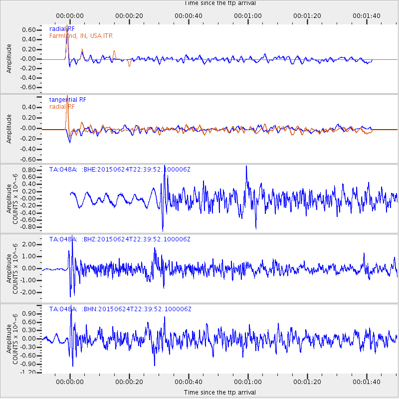
O48A Farmland, IN, USA - Earthquake Result Viewer
*The percent match for this event was below the threshold and hence no stack was calculated.
| Earthquake location: |
Southern Alaska |
| Earthquake latitude/longitude: |
61.7/-152.0 |
| Earthquake time(UTC): |
2015/06/24 (175) 22:32:20 GMT |
| Earthquake Depth: |
105 km |
| Earthquake Magnitude: |
5.7 MB, 6.2 MB |
| Earthquake Catalog/Contributor: |
NEIC PDE/NEIC ALERT |
|
| Network: |
TA USArray Transportable Network (new EarthScope stations) |
| Station: |
O48A Farmland, IN, USA |
| Lat/Lon: |
40.26 N/85.16 W |
| Elevation: |
300 m |
|
| Distance: |
44.8 deg |
| Az: |
86.605 deg |
| Baz: |
321.619 deg |
| Ray Param: |
$rayparam |
*The percent match for this event was below the threshold and hence was not used in the summary stack. |
|
| Radial Match: |
61.648846 % |
| Radial Bump: |
400 |
| Transverse Match: |
68.80179 % |
| Transverse Bump: |
400 |
| SOD ConfigId: |
7422571 |
| Insert Time: |
2019-04-19 11:24:54.735 +0000 |
| GWidth: |
2.5 |
| Max Bumps: |
400 |
| Tol: |
0.001 |
|
Signal To Noise
| Channel | StoN | STA | LTA |
| TA:O48A: :BHZ:20150624T22:39:52.100006Z | 10.199907 | 9.647357E-7 | 9.45828E-8 |
| TA:O48A: :BHN:20150624T22:39:52.100006Z | 4.0586987 | 4.1931094E-7 | 1.0331167E-7 |
| TA:O48A: :BHE:20150624T22:39:52.100006Z | 3.0708 | 3.4794053E-7 | 1.1330615E-7 |
| Arrivals |
| Ps | |
| PpPs | |
| PsPs/PpSs | |


