You are here: Home > Network List > IU - Global Seismograph Network (GSN - IRIS/USGS) Stations List
> Station CCM Cathedral Cave, Missouri, USA > Earthquake Result Viewer
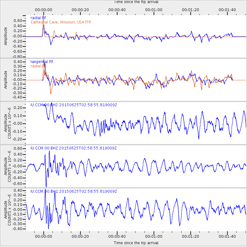
CCM Cathedral Cave, Missouri, USA - Earthquake Result Viewer
*The percent match for this event was below the threshold and hence no stack was calculated.
| Earthquake location: |
Panama-Costa Rica Border Region |
| Earthquake latitude/longitude: |
8.2/-82.8 |
| Earthquake time(UTC): |
2015/06/25 (176) 02:53:11 GMT |
| Earthquake Depth: |
8.4 km |
| Earthquake Magnitude: |
4.8 MW, 5.0 mb, 4.1 MS |
| Earthquake Catalog/Contributor: |
ISC/ISC |
|
| Network: |
IU Global Seismograph Network (GSN - IRIS/USGS) |
| Station: |
CCM Cathedral Cave, Missouri, USA |
| Lat/Lon: |
38.06 N/91.24 W |
| Elevation: |
222 m |
|
| Distance: |
30.7 deg |
| Az: |
346.839 deg |
| Baz: |
163.411 deg |
| Ray Param: |
$rayparam |
*The percent match for this event was below the threshold and hence was not used in the summary stack. |
|
| Radial Match: |
62.01136 % |
| Radial Bump: |
400 |
| Transverse Match: |
45.509335 % |
| Transverse Bump: |
400 |
| SOD ConfigId: |
7422571 |
| Insert Time: |
2019-04-19 11:30:38.088 +0000 |
| GWidth: |
2.5 |
| Max Bumps: |
400 |
| Tol: |
0.001 |
|
Signal To Noise
| Channel | StoN | STA | LTA |
| IU:CCM:00:BHZ:20150625T02:58:55.819009Z | 2.8592775 | 2.613044E-7 | 9.1388266E-8 |
| IU:CCM:00:BH1:20150625T02:58:55.819009Z | 1.7810813 | 2.3360406E-7 | 1.3115856E-7 |
| IU:CCM:00:BH2:20150625T02:58:55.819009Z | 1.0025257 | 9.605023E-8 | 9.580825E-8 |
| Arrivals |
| Ps | |
| PpPs | |
| PsPs/PpSs | |


