You are here: Home > Network List > TA - USArray Transportable Network (new EarthScope stations) Stations List
> Station I23K Minto, Yukon-Koyukuk, AK, USA > Earthquake Result Viewer
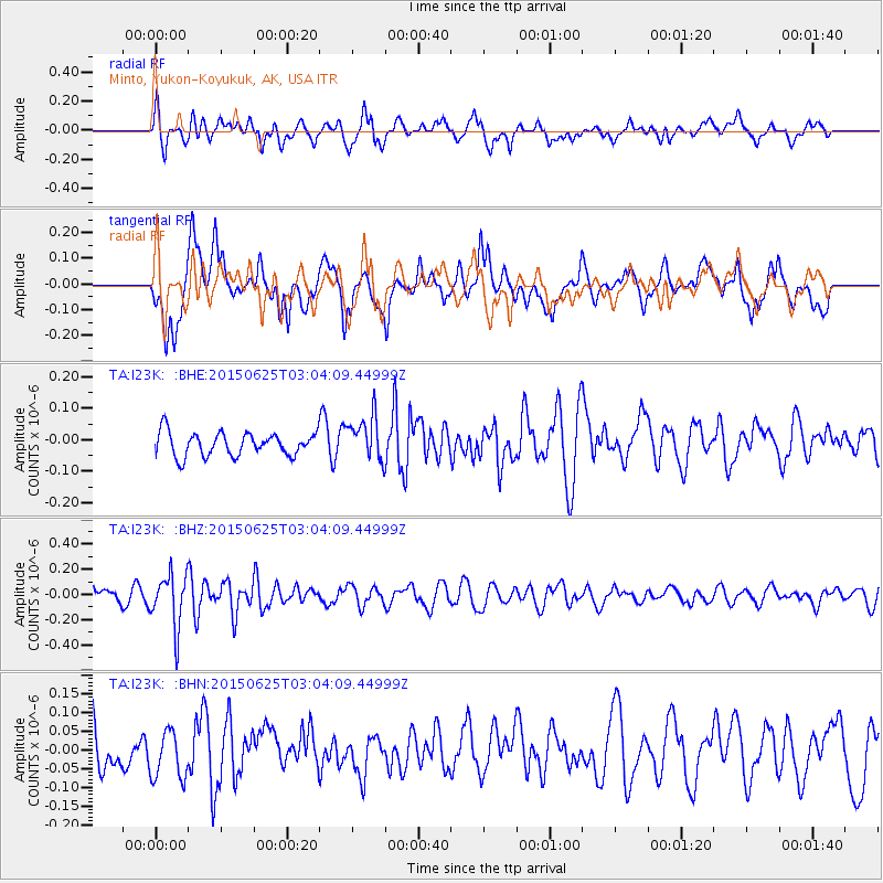
I23K Minto, Yukon-Koyukuk, AK, USA - Earthquake Result Viewer
*The percent match for this event was below the threshold and hence no stack was calculated.
| Earthquake location: |
Panama-Costa Rica Border Region |
| Earthquake latitude/longitude: |
8.2/-82.8 |
| Earthquake time(UTC): |
2015/06/25 (176) 02:53:11 GMT |
| Earthquake Depth: |
8.4 km |
| Earthquake Magnitude: |
4.8 MW, 5.0 mb, 4.1 MS |
| Earthquake Catalog/Contributor: |
ISC/ISC |
|
| Network: |
TA USArray Transportable Network (new EarthScope stations) |
| Station: |
I23K Minto, Yukon-Koyukuk, AK, USA |
| Lat/Lon: |
65.15 N/149.36 W |
| Elevation: |
149 m |
|
| Distance: |
72.8 deg |
| Az: |
336.055 deg |
| Baz: |
108.082 deg |
| Ray Param: |
$rayparam |
*The percent match for this event was below the threshold and hence was not used in the summary stack. |
|
| Radial Match: |
64.37122 % |
| Radial Bump: |
400 |
| Transverse Match: |
68.49683 % |
| Transverse Bump: |
400 |
| SOD ConfigId: |
7422571 |
| Insert Time: |
2019-04-19 11:33:09.465 +0000 |
| GWidth: |
2.5 |
| Max Bumps: |
400 |
| Tol: |
0.001 |
|
Signal To Noise
| Channel | StoN | STA | LTA |
| TA:I23K: :BHZ:20150625T03:04:09.44999Z | 3.2191696 | 2.0873682E-7 | 6.484182E-8 |
| TA:I23K: :BHN:20150625T03:04:09.44999Z | 1.079183 | 6.927314E-8 | 6.419036E-8 |
| TA:I23K: :BHE:20150625T03:04:09.44999Z | 1.8961551 | 7.030423E-8 | 3.7077257E-8 |
| Arrivals |
| Ps | |
| PpPs | |
| PsPs/PpSs | |


