You are here: Home > Network List > TA - USArray Transportable Network (new EarthScope stations) Stations List
> Station O48A Farmland, IN, USA > Earthquake Result Viewer
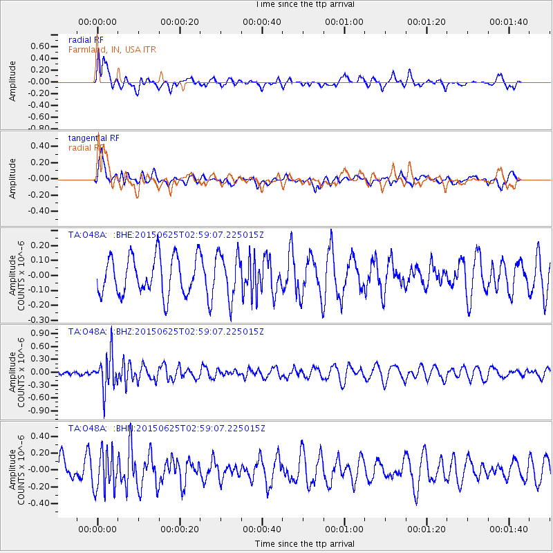
O48A Farmland, IN, USA - Earthquake Result Viewer
*The percent match for this event was below the threshold and hence no stack was calculated.
| Earthquake location: |
Panama-Costa Rica Border Region |
| Earthquake latitude/longitude: |
8.2/-82.8 |
| Earthquake time(UTC): |
2015/06/25 (176) 02:53:11 GMT |
| Earthquake Depth: |
8.4 km |
| Earthquake Magnitude: |
4.8 MW, 5.0 mb, 4.1 MS |
| Earthquake Catalog/Contributor: |
ISC/ISC |
|
| Network: |
TA USArray Transportable Network (new EarthScope stations) |
| Station: |
O48A Farmland, IN, USA |
| Lat/Lon: |
40.26 N/85.16 W |
| Elevation: |
300 m |
|
| Distance: |
32.0 deg |
| Az: |
356.575 deg |
| Baz: |
175.568 deg |
| Ray Param: |
$rayparam |
*The percent match for this event was below the threshold and hence was not used in the summary stack. |
|
| Radial Match: |
42.64371 % |
| Radial Bump: |
400 |
| Transverse Match: |
48.234802 % |
| Transverse Bump: |
400 |
| SOD ConfigId: |
7422571 |
| Insert Time: |
2019-04-19 11:33:23.760 +0000 |
| GWidth: |
2.5 |
| Max Bumps: |
400 |
| Tol: |
0.001 |
|
Signal To Noise
| Channel | StoN | STA | LTA |
| TA:O48A: :BHZ:20150625T02:59:07.225015Z | 4.164389 | 4.1669213E-7 | 1.000608E-7 |
| TA:O48A: :BHN:20150625T02:59:07.225015Z | 1.1819814 | 2.2505677E-7 | 1.9040634E-7 |
| TA:O48A: :BHE:20150625T02:59:07.225015Z | 1.2063833 | 1.5248284E-7 | 1.2639667E-7 |
| Arrivals |
| Ps | |
| PpPs | |
| PsPs/PpSs | |


