You are here: Home > Network List > US - United States National Seismic Network Stations List
> Station AMTX Amarillo, Texas, USA > Earthquake Result Viewer
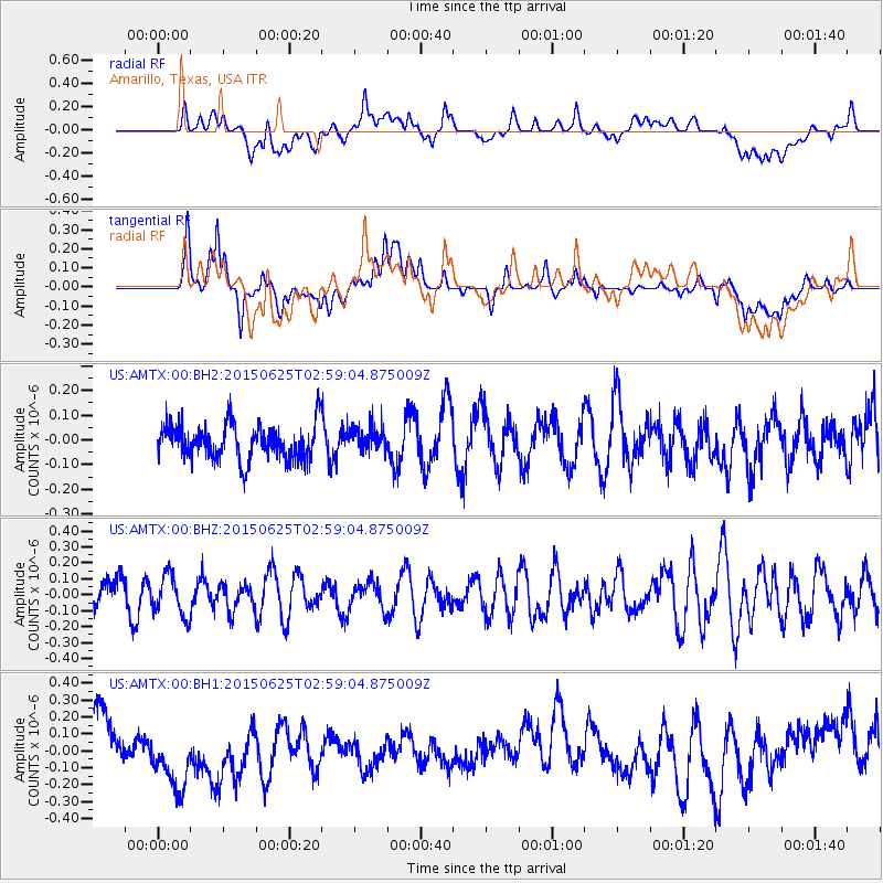
AMTX Amarillo, Texas, USA - Earthquake Result Viewer
*The percent match for this event was below the threshold and hence no stack was calculated.
| Earthquake location: |
Panama-Costa Rica Border Region |
| Earthquake latitude/longitude: |
8.2/-82.8 |
| Earthquake time(UTC): |
2015/06/25 (176) 02:53:11 GMT |
| Earthquake Depth: |
8.4 km |
| Earthquake Magnitude: |
4.8 MW, 5.0 mb, 4.1 MS |
| Earthquake Catalog/Contributor: |
ISC/ISC |
|
| Network: |
US United States National Seismic Network |
| Station: |
AMTX Amarillo, Texas, USA |
| Lat/Lon: |
34.53 N/101.41 W |
| Elevation: |
1010 m |
|
| Distance: |
31.3 deg |
| Az: |
329.481 deg |
| Baz: |
142.494 deg |
| Ray Param: |
$rayparam |
*The percent match for this event was below the threshold and hence was not used in the summary stack. |
|
| Radial Match: |
41.867577 % |
| Radial Bump: |
400 |
| Transverse Match: |
66.8217 % |
| Transverse Bump: |
400 |
| SOD ConfigId: |
7422571 |
| Insert Time: |
2019-04-19 11:33:44.341 +0000 |
| GWidth: |
2.5 |
| Max Bumps: |
400 |
| Tol: |
0.001 |
|
Signal To Noise
| Channel | StoN | STA | LTA |
| US:AMTX:00:BHZ:20150625T02:59:04.875009Z | 1.007531 | 1.2675387E-7 | 1.2580642E-7 |
| US:AMTX:00:BH1:20150625T02:59:04.875009Z | 2.1045773 | 2.3313297E-7 | 1.10774245E-7 |
| US:AMTX:00:BH2:20150625T02:59:04.875009Z | 0.8742446 | 5.753543E-8 | 6.58116E-8 |
| Arrivals |
| Ps | |
| PpPs | |
| PsPs/PpSs | |


