
BILL Bilibino, Russia - Earthquake Result Viewer
| ||||||||||||||||||
| ||||||||||||||||||
| ||||||||||||||||||
|
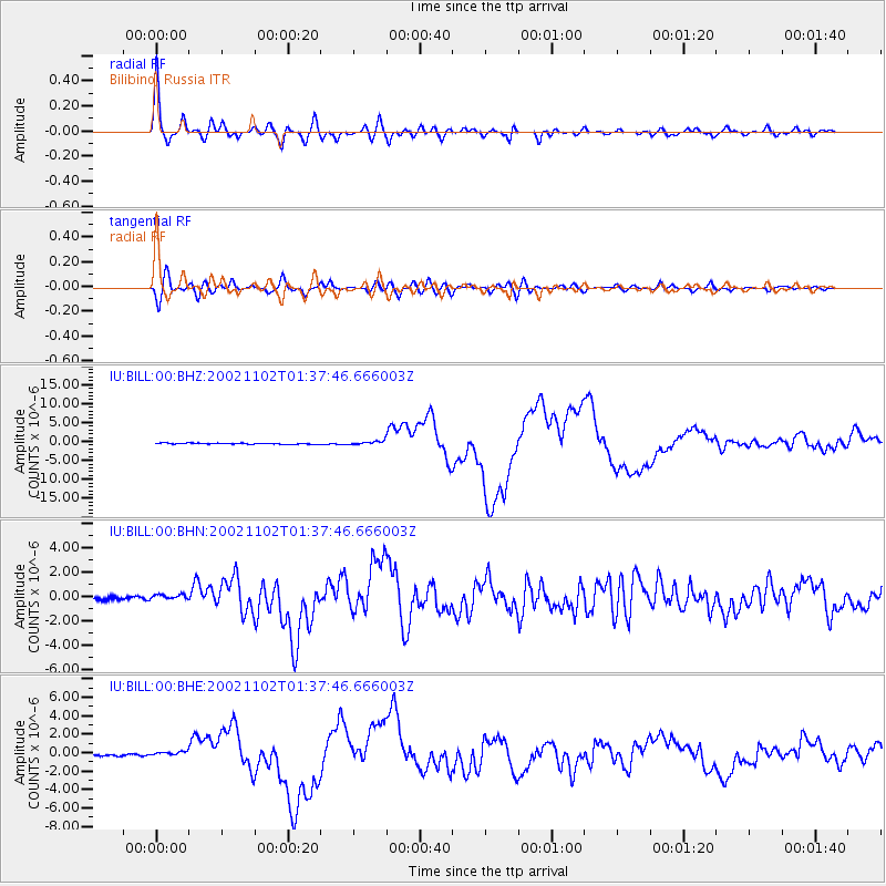
Signal To Noise
| Channel | StoN | STA | LTA |
| IU:BILL:00:BHN:20021102T01:37:46.666003Z | 1.2281014 | 2.0526214E-7 | 1.6713778E-7 |
| IU:BILL:00:BHE:20021102T01:37:46.666003Z | 1.9320791 | 5.1654445E-7 | 2.6735162E-7 |
| IU:BILL:00:BHZ:20021102T01:37:46.666003Z | 3.1486924 | 4.6813204E-7 | 1.4867506E-7 |
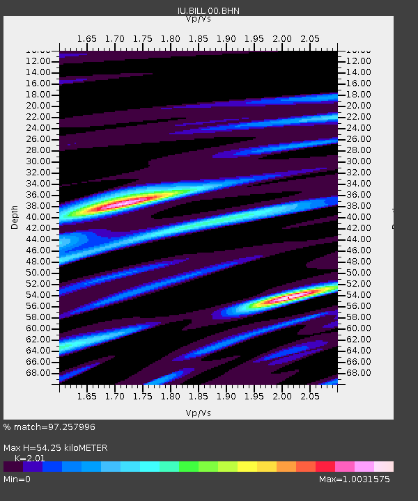
| Arrivals | |
| Ps | 8.6 SECOND |
| PpPs | 24 SECOND |
| PsPs/PpSs | 33 SECOND |

