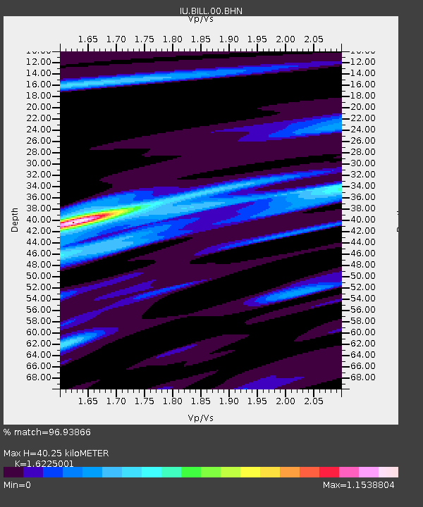
BILL Bilibino, Russia - Earthquake Result Viewer
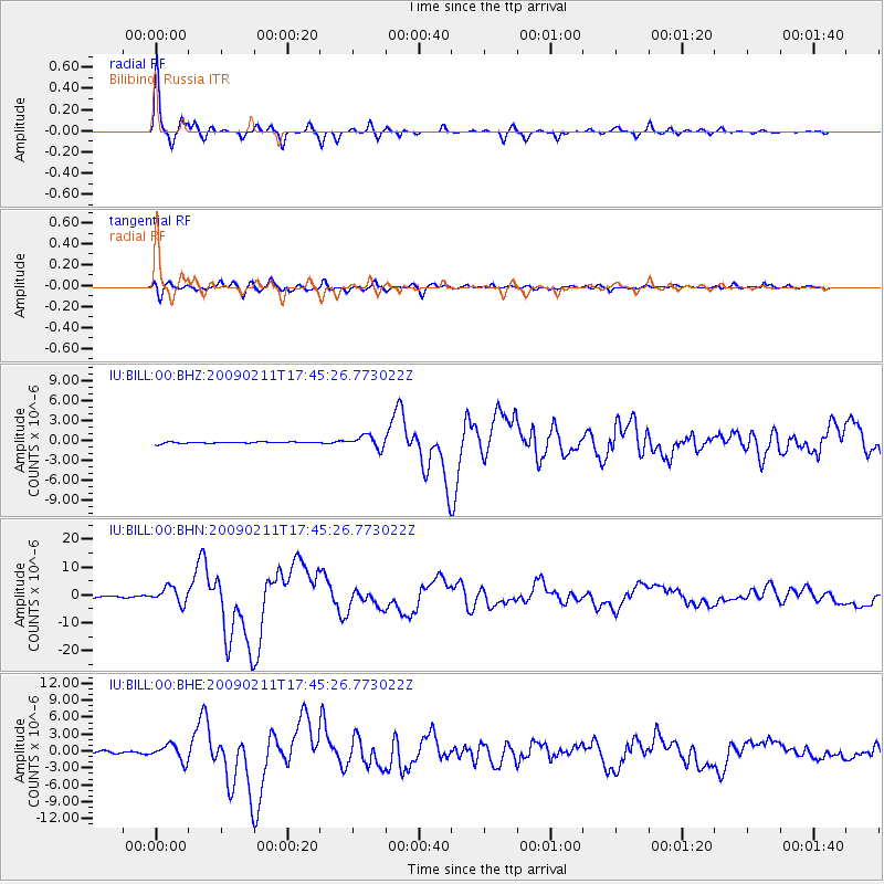
Earthquake location: Talaud Islands, Indonesia
Earthquake latitude/longitude: 3.9/126.4
Earthquake time(UTC): 2009/02/11 (042) 17:34:50 GMT
Earthquake Depth: 22 km
Earthquake Magnitude: 6.6 MB, 7.2 MS, 7.2 MW, 7.1 MW
Earthquake Catalog/Contributor: WHDF/NEIC
Network: IU Global Seismograph Network (GSN - IRIS/USGS)
Station: BILL Bilibino, Russia
Lat/Lon: 68.07 N/166.45 E
Elevation: 299 m
Distance: 69.6 deg
Az: 14.954 deg
Baz: 223.254 deg
Ray Param: 0.055543862
Estimated Moho Depth: 40.25 km
Estimated Crust Vp/Vs: 1.62
Assumed Crust Vp: 6.577 km/s
Estimated Crust Vs: 4.053 km/s
Estimated Crust Poisson's Ratio: 0.19
Radial Match: 96.93866 %
Radial Bump: 251
Transverse Match: 86.625336 %
Transverse Bump: 400
SOD ConfigId: 2658
Insert Time: 2010-03-03 15:13:30.915 +0000
GWidth: 2.5
Max Bumps: 400
Tol: 0.001

Signal To Noise

ChannelStoNSTALTA
IU:BILL:00:BHN:20090211T17:45:26.773022Z11.1793622.872772E-62.56971E-7
IU:BILL:00:BHE:20090211T17:45:26.773022Z6.29787061.4372451E-62.2821129E-7
IU:BILL:00:BHZ:20090211T17:45:26.773022Z8.6335829.362852E-71.084469E-7
Arrivals
Ps4.0 SECOND
PpPs15 SECOND
PsPs/PpSs19 SECOND