You are here: Home > Network List > CI - Caltech Regional Seismic Network Stations List
> Station MPM Manuel Prospect Mine, California, USA > Earthquake Result Viewer
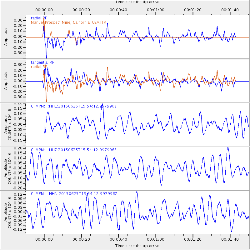
MPM Manuel Prospect Mine, California, USA - Earthquake Result Viewer
*The percent match for this event was below the threshold and hence no stack was calculated.
| Earthquake location: |
D'Entrecasteaux Islands Region |
| Earthquake latitude/longitude: |
-10.4/152.1 |
| Earthquake time(UTC): |
2015/06/25 (176) 15:41:15 GMT |
| Earthquake Depth: |
10 km |
| Earthquake Magnitude: |
5.4 MW, 5.3 mb, 4.9 MS |
| Earthquake Catalog/Contributor: |
ISC/ISC |
|
| Network: |
CI Caltech Regional Seismic Network |
| Station: |
MPM Manuel Prospect Mine, California, USA |
| Lat/Lon: |
36.06 N/117.49 W |
| Elevation: |
185 m |
|
| Distance: |
96.3 deg |
| Az: |
54.612 deg |
| Baz: |
261.825 deg |
| Ray Param: |
$rayparam |
*The percent match for this event was below the threshold and hence was not used in the summary stack. |
|
| Radial Match: |
66.02942 % |
| Radial Bump: |
400 |
| Transverse Match: |
64.98628 % |
| Transverse Bump: |
400 |
| SOD ConfigId: |
7422571 |
| Insert Time: |
2019-04-19 11:48:25.514 +0000 |
| GWidth: |
2.5 |
| Max Bumps: |
400 |
| Tol: |
0.001 |
|
Signal To Noise
| Channel | StoN | STA | LTA |
| CI:MPM: :HHZ:20150625T15:54:12.997996Z | 1.0623852 | 8.081378E-8 | 7.606825E-8 |
| CI:MPM: :HHN:20150625T15:54:12.997996Z | 1.518506 | 6.230258E-8 | 4.1028866E-8 |
| CI:MPM: :HHE:20150625T15:54:12.997996Z | 2.1742861 | 1.1372756E-7 | 5.23057E-8 |
| Arrivals |
| Ps | |
| PpPs | |
| PsPs/PpSs | |


