BILL Bilibino, Russia - Earthquake Result Viewer
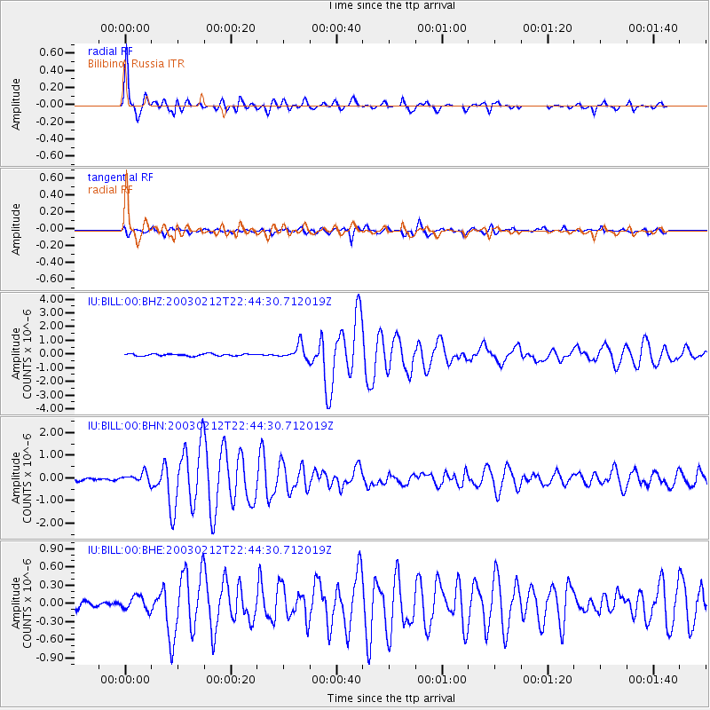
Earthquake location: Near N Coast Of New Guinea, P.N.G.
Earthquake latitude/longitude: -3.7/144.2
Earthquake time(UTC): 2003/02/12 (043) 22:33:30 GMT
Earthquake Depth: 10 km
Earthquake Magnitude: 6.0 MB, 6.1 MS, 6.2 MW, 6.2 MW
Earthquake Catalog/Contributor: WHDF/NEIC
Network: IU Global Seismograph Network (GSN - IRIS/USGS)
Station: BILL Bilibino, Russia
Lat/Lon: 68.07 N/166.45 E
Elevation: 299 m
Distance: 73.2 deg
Az: 8.53 deg
Baz: 203.204 deg
Ray Param: 0.05314003
Estimated Moho Depth: 27.75 km
Estimated Crust Vp/Vs: 1.88
Assumed Crust Vp: 6.577 km/s
Estimated Crust Vs: 3.503 km/s
Estimated Crust Poisson's Ratio: 0.30
Radial Match: 95.6675 %
Radial Bump: 400
Transverse Match: 87.708176 %
Transverse Bump: 400
SOD ConfigId: 4714
Insert Time: 2010-03-03 15:13:48.803 +0000
GWidth: 2.5
Max Bumps: 400
Tol: 0.001

Signal To Noise

ChannelStoNSTALTA
IU:BILL:00:BHN:20030212T22:44:30.712019Z3.28812892.2261487E-76.77026E-8
IU:BILL:00:BHE:20030212T22:44:30.712019Z1.33178771.2413929E-79.321252E-8
IU:BILL:00:BHZ:20030212T22:44:30.712019Z7.25767475.326524E-77.3391604E-8
Arrivals
Ps3.8 SECOND
PpPs12 SECOND
PsPs/PpSs16 SECOND