You are here: Home > Network List > GS - US Geological Survey Networks Stations List
> Station DEC05 Decatur Surface Seismic Site, Decatur, IL, USA > Earthquake Result Viewer
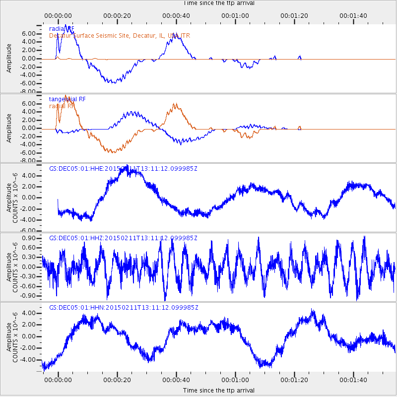
DEC05 Decatur Surface Seismic Site, Decatur, IL, USA - Earthquake Result Viewer
*The percent match for this event was below the threshold and hence no stack was calculated.
| Earthquake location: |
Jujuy Province, Argentina |
| Earthquake latitude/longitude: |
-23.5/-66.7 |
| Earthquake time(UTC): |
2015/02/11 (042) 13:01:15 GMT |
| Earthquake Depth: |
201 km |
| Earthquake Magnitude: |
5.5 MWW |
| Earthquake Catalog/Contributor: |
NEIC PDE/NEIC COMCAT |
|
| Network: |
GS US Geological Survey Networks |
| Station: |
DEC05 Decatur Surface Seismic Site, Decatur, IL, USA |
| Lat/Lon: |
39.87 N/88.87 W |
| Elevation: |
216 m |
|
| Distance: |
66.4 deg |
| Az: |
341.535 deg |
| Baz: |
157.81 deg |
| Ray Param: |
$rayparam |
*The percent match for this event was below the threshold and hence was not used in the summary stack. |
|
| Radial Match: |
55.461235 % |
| Radial Bump: |
400 |
| Transverse Match: |
61.893047 % |
| Transverse Bump: |
400 |
| SOD ConfigId: |
872571 |
| Insert Time: |
2015-02-25 13:10:39.118 +0000 |
| GWidth: |
2.5 |
| Max Bumps: |
400 |
| Tol: |
0.001 |
|
Signal To Noise
| Channel | StoN | STA | LTA |
| GS:DEC05:01:HHZ:20150211T13:11:12.099985Z | 1.1092824 | 3.5106672E-7 | 3.1648094E-7 |
| GS:DEC05:01:HHN:20150211T13:11:12.099985Z | 0.8862495 | 3.2510013E-6 | 3.6682688E-6 |
| GS:DEC05:01:HHE:20150211T13:11:12.099985Z | 0.7167678 | 2.304027E-6 | 3.2144678E-6 |
| Arrivals |
| Ps | |
| PpPs | |
| PsPs/PpSs | |


