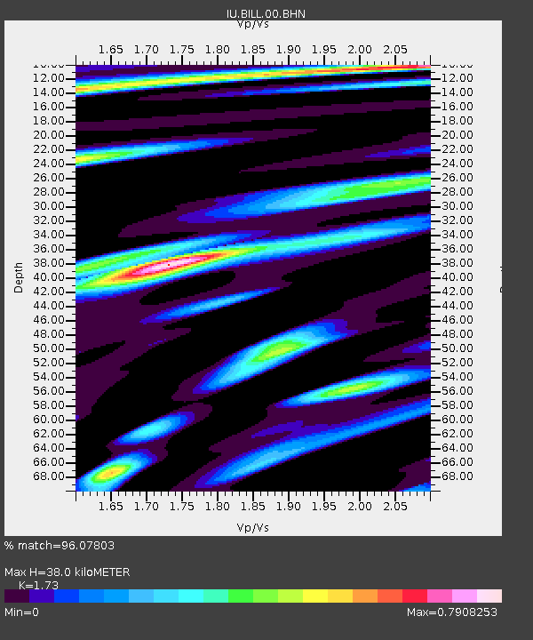
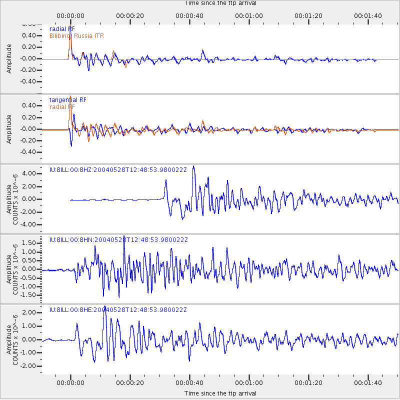
BILL Bilibino, Russia - Earthquake Result Viewer

Earthquake location: Northern And Central Iran
Earthquake latitude/longitude: 36.2/51.6
Earthquake time(UTC): 2004/05/28 (149) 12:38:44 GMT
Earthquake Depth: 17 km
Earthquake Magnitude: 6.2 MB, 6.4 MS, 6.3 MW, 6.2 MW
Earthquake Catalog/Contributor: WHDF/NEIC
Network: IU Global Seismograph Network (GSN - IRIS/USGS)
Station: BILL Bilibino, Russia
Lat/Lon: 68.07 N/166.45 E
Elevation: 299 m
Distance: 65.3 deg
Az: 22.046 deg
Baz: 306.141 deg
Ray Param: 0.058354866
Estimated Moho Depth: 38.0 km
Estimated Crust Vp/Vs: 1.73
Assumed Crust Vp: 6.577 km/s
Estimated Crust Vs: 3.802 km/s
Estimated Crust Poisson's Ratio: 0.25
Radial Match: 96.07803 %
Radial Bump: 400
Transverse Match: 94.79661 %
Transverse Bump: 400
SOD ConfigId: 2459
Insert Time: 2010-03-03 15:14:07.435 +0000
GWidth: 2.5
Max Bumps: 400
Tol: 0.001

Signal To Noise

ChannelStoNSTALTA
IU:BILL:00:BHN:20040528T12:48:53.980022Z5.83733652.8446487E-74.8731966E-8
IU:BILL:00:BHE:20040528T12:48:53.980022Z11.57302955.6640846E-74.894211E-8
IU:BILL:00:BHZ:20040528T12:48:53.980022Z31.9327451.2784833E-64.003675E-8
Arrivals
Ps4.4 SECOND
PpPs15 SECOND
PsPs/PpSs19 SECOND