You are here: Home > Network List > CI - Caltech Regional Seismic Network Stations List
> Station MPP McPhearson Peak > Earthquake Result Viewer
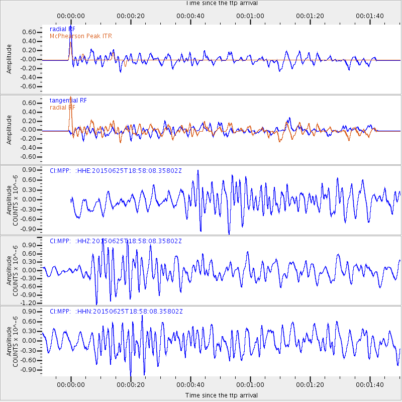
MPP McPhearson Peak - Earthquake Result Viewer
*The percent match for this event was below the threshold and hence no stack was calculated.
| Earthquake location: |
South Of Kermadec Islands |
| Earthquake latitude/longitude: |
-32.0/-178.2 |
| Earthquake time(UTC): |
2015/06/25 (176) 18:45:58 GMT |
| Earthquake Depth: |
10 km |
| Earthquake Magnitude: |
5.8 MB |
| Earthquake Catalog/Contributor: |
NEIC PDE/NEIC ALERT |
|
| Network: |
CI Caltech Regional Seismic Network |
| Station: |
MPP McPhearson Peak |
| Lat/Lon: |
34.89 N/119.81 W |
| Elevation: |
1739 m |
|
| Distance: |
86.3 deg |
| Az: |
44.549 deg |
| Baz: |
226.444 deg |
| Ray Param: |
$rayparam |
*The percent match for this event was below the threshold and hence was not used in the summary stack. |
|
| Radial Match: |
71.871445 % |
| Radial Bump: |
400 |
| Transverse Match: |
57.19914 % |
| Transverse Bump: |
400 |
| SOD ConfigId: |
7422571 |
| Insert Time: |
2019-04-19 11:53:38.515 +0000 |
| GWidth: |
2.5 |
| Max Bumps: |
400 |
| Tol: |
0.001 |
|
Signal To Noise
| Channel | StoN | STA | LTA |
| CI:MPP: :HHZ:20150625T18:58:08.35802Z | 0.81102896 | 1.15066264E-7 | 1.4187688E-7 |
| CI:MPP: :HHN:20150625T18:58:08.35802Z | 0.98058814 | 1.9732464E-7 | 2.0123092E-7 |
| CI:MPP: :HHE:20150625T18:58:08.35802Z | 0.83796775 | 1.6582526E-7 | 1.9788978E-7 |
| Arrivals |
| Ps | |
| PpPs | |
| PsPs/PpSs | |


