You are here: Home > Network List > UW - Pacific Northwest Regional Seismic Network Stations List
> Station UMAT Pilot Rock, OR, USA > Earthquake Result Viewer
UMAT Pilot Rock, OR, USA - Earthquake Result Viewer
*The percent match for this event was below the threshold and hence no stack was calculated.
| Earthquake location: |
South Of Kermadec Islands |
| Earthquake latitude/longitude: |
-32.0/-178.2 |
| Earthquake time(UTC): |
2015/06/25 (176) 18:45:58 GMT |
| Earthquake Depth: |
10 km |
| Earthquake Magnitude: |
5.8 MB |
| Earthquake Catalog/Contributor: |
NEIC PDE/NEIC ALERT |
|
| Network: |
UW Pacific Northwest Regional Seismic Network |
| Station: |
UMAT Pilot Rock, OR, USA |
| Lat/Lon: |
45.29 N/118.96 W |
| Elevation: |
1318 m |
|
| Distance: |
93.9 deg |
| Az: |
37.44 deg |
| Baz: |
227.002 deg |
| Ray Param: |
$rayparam |
*The percent match for this event was below the threshold and hence was not used in the summary stack. |
|
| Radial Match: |
51.13189 % |
| Radial Bump: |
400 |
| Transverse Match: |
42.212776 % |
| Transverse Bump: |
400 |
| SOD ConfigId: |
7422571 |
| Insert Time: |
2019-04-19 11:55:50.583 +0000 |
| GWidth: |
2.5 |
| Max Bumps: |
400 |
| Tol: |
0.001 |
|
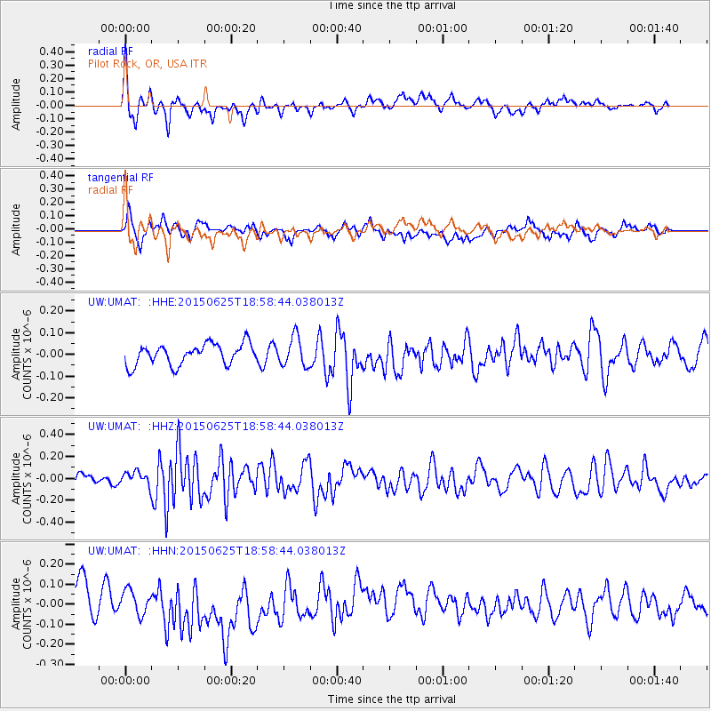
Signal To Noise
| Channel | StoN | STA | LTA |
| UW:UMAT: :HHZ:20150625T18:58:44.038013Z | 0.97503746 | 6.724056E-8 | 6.896204E-8 |
| UW:UMAT: :HHN:20150625T18:58:44.038013Z | 0.9417467 | 6.0258785E-8 | 6.398619E-8 |
| UW:UMAT: :HHE:20150625T18:58:44.038013Z | 1.4432591 | 6.923078E-8 | 4.7968364E-8 |
| Arrivals |
| Ps | |
| PpPs | |
| PsPs/PpSs | |


