
BILL Bilibino, Russia - Earthquake Result Viewer
| ||||||||||||||||||
| ||||||||||||||||||
| ||||||||||||||||||
|
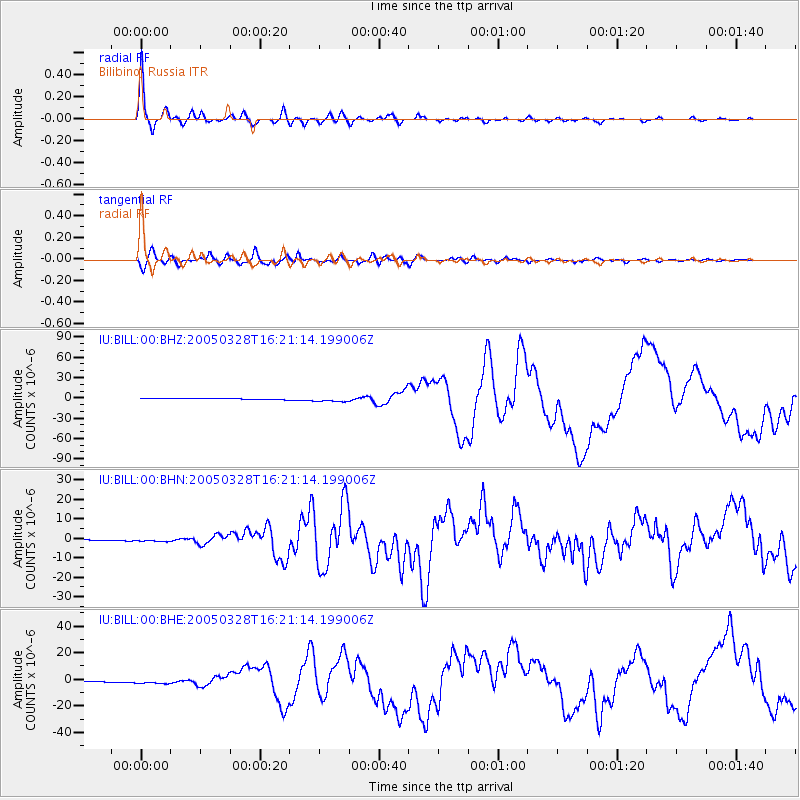
Signal To Noise
| Channel | StoN | STA | LTA |
| IU:BILL:00:BHN:20050328T16:21:14.199006Z | 3.163224 | 4.917673E-7 | 1.5546397E-7 |
| IU:BILL:00:BHE:20050328T16:21:14.199006Z | 5.210159 | 1.6604877E-6 | 3.1870192E-7 |
| IU:BILL:00:BHZ:20050328T16:21:14.199006Z | 4.480588 | 3.652154E-6 | 8.15106E-7 |
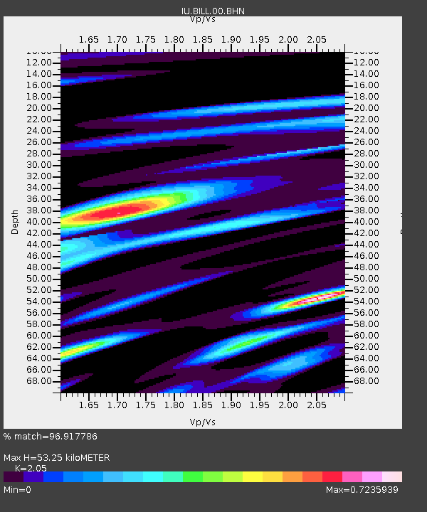
| Arrivals | |
| Ps | 8.7 SECOND |
| PpPs | 24 SECOND |
| PsPs/PpSs | 33 SECOND |

