You are here: Home > Network List > TA - USArray Transportable Network (new EarthScope stations) Stations List
> Station MDND Maddock, ND, USA > Earthquake Result Viewer
MDND Maddock, ND, USA - Earthquake Result Viewer
*The percent match for this event was below the threshold and hence no stack was calculated.
| Earthquake location: |
Kuril Islands |
| Earthquake latitude/longitude: |
45.2/148.9 |
| Earthquake time(UTC): |
2015/06/26 (177) 07:21:30 GMT |
| Earthquake Depth: |
122 km |
| Earthquake Magnitude: |
4.3 mb, 4.0 mb |
| Earthquake Catalog/Contributor: |
ISC/ISC |
|
| Network: |
TA USArray Transportable Network (new EarthScope stations) |
| Station: |
MDND Maddock, ND, USA |
| Lat/Lon: |
47.85 N/99.60 W |
| Elevation: |
479 m |
|
| Distance: |
69.6 deg |
| Az: |
41.979 deg |
| Baz: |
315.431 deg |
| Ray Param: |
$rayparam |
*The percent match for this event was below the threshold and hence was not used in the summary stack. |
|
| Radial Match: |
57.390175 % |
| Radial Bump: |
400 |
| Transverse Match: |
66.48519 % |
| Transverse Bump: |
400 |
| SOD ConfigId: |
7422571 |
| Insert Time: |
2019-04-19 12:16:58.352 +0000 |
| GWidth: |
2.5 |
| Max Bumps: |
400 |
| Tol: |
0.001 |
|
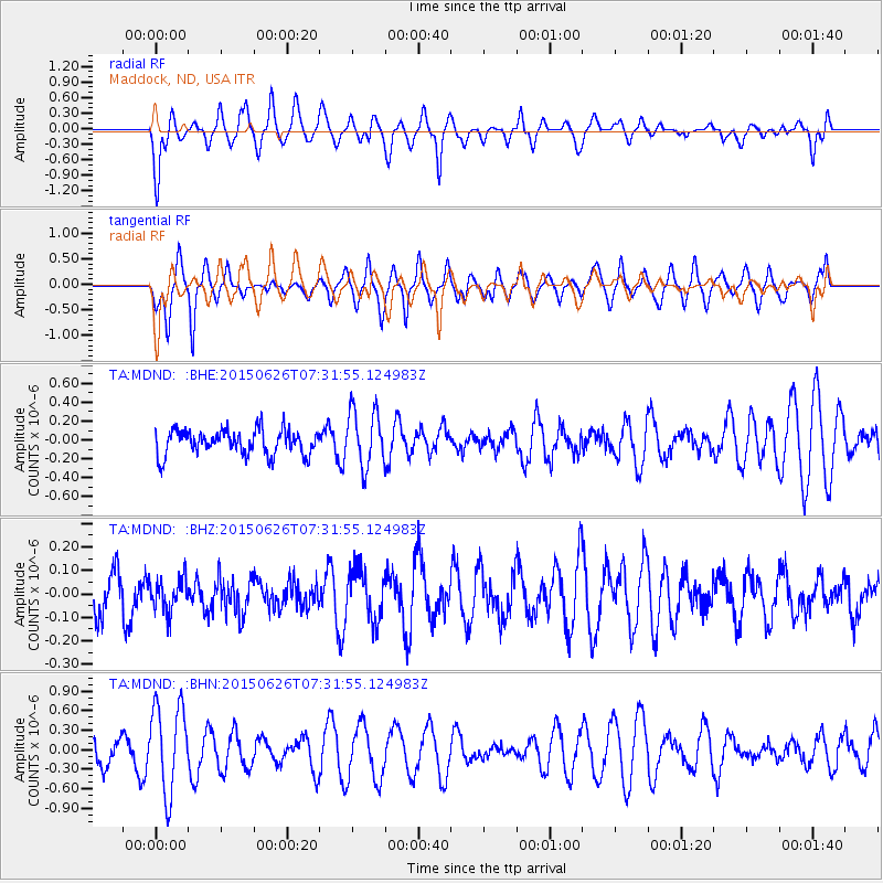
Signal To Noise
| Channel | StoN | STA | LTA |
| TA:MDND: :BHZ:20150626T07:31:55.124983Z | 0.5996427 | 6.9103436E-8 | 1.1524102E-7 |
| TA:MDND: :BHN:20150626T07:31:55.124983Z | 2.6394017 | 6.772629E-7 | 2.5659713E-7 |
| TA:MDND: :BHE:20150626T07:31:55.124983Z | 2.2656634 | 2.978299E-7 | 1.3145373E-7 |
| Arrivals |
| Ps | |
| PpPs | |
| PsPs/PpSs | |


