You are here: Home > Network List > TA - USArray Transportable Network (new EarthScope stations) Stations List
> Station R11A Troy Canyon, Currant, NV, USA > Earthquake Result Viewer
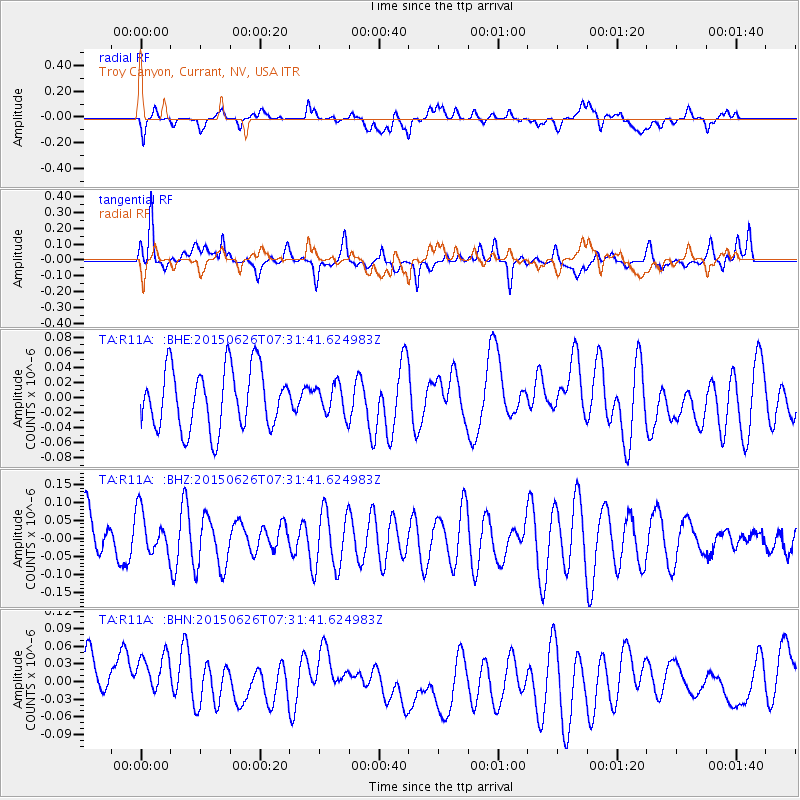
R11A Troy Canyon, Currant, NV, USA - Earthquake Result Viewer
*The percent match for this event was below the threshold and hence no stack was calculated.
| Earthquake location: |
Kuril Islands |
| Earthquake latitude/longitude: |
45.2/148.9 |
| Earthquake time(UTC): |
2015/06/26 (177) 07:21:30 GMT |
| Earthquake Depth: |
122 km |
| Earthquake Magnitude: |
4.3 mb, 4.0 mb |
| Earthquake Catalog/Contributor: |
ISC/ISC |
|
| Network: |
TA USArray Transportable Network (new EarthScope stations) |
| Station: |
R11A Troy Canyon, Currant, NV, USA |
| Lat/Lon: |
38.35 N/115.59 W |
| Elevation: |
1756 m |
|
| Distance: |
67.4 deg |
| Az: |
57.962 deg |
| Baz: |
310.366 deg |
| Ray Param: |
$rayparam |
*The percent match for this event was below the threshold and hence was not used in the summary stack. |
|
| Radial Match: |
48.499508 % |
| Radial Bump: |
400 |
| Transverse Match: |
58.196396 % |
| Transverse Bump: |
400 |
| SOD ConfigId: |
7422571 |
| Insert Time: |
2019-04-19 12:17:03.800 +0000 |
| GWidth: |
2.5 |
| Max Bumps: |
400 |
| Tol: |
0.001 |
|
Signal To Noise
| Channel | StoN | STA | LTA |
| TA:R11A: :BHZ:20150626T07:31:41.624983Z | 0.97573507 | 5.997144E-8 | 6.1462835E-8 |
| TA:R11A: :BHN:20150626T07:31:41.624983Z | 1.3641907 | 4.9175505E-8 | 3.6047382E-8 |
| TA:R11A: :BHE:20150626T07:31:41.624983Z | 0.49417824 | 1.9749107E-8 | 3.996353E-8 |
| Arrivals |
| Ps | |
| PpPs | |
| PsPs/PpSs | |


