You are here: Home > Network List > US - United States National Seismic Network Stations List
> Station EGMT Eagleton, Montana, USA > Earthquake Result Viewer
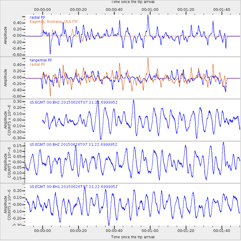
EGMT Eagleton, Montana, USA - Earthquake Result Viewer
*The percent match for this event was below the threshold and hence no stack was calculated.
| Earthquake location: |
Kuril Islands |
| Earthquake latitude/longitude: |
45.2/148.9 |
| Earthquake time(UTC): |
2015/06/26 (177) 07:21:30 GMT |
| Earthquake Depth: |
122 km |
| Earthquake Magnitude: |
4.3 mb, 4.0 mb |
| Earthquake Catalog/Contributor: |
ISC/ISC |
|
| Network: |
US United States National Seismic Network |
| Station: |
EGMT Eagleton, Montana, USA |
| Lat/Lon: |
48.02 N/109.75 W |
| Elevation: |
1055 m |
|
| Distance: |
64.4 deg |
| Az: |
46.855 deg |
| Baz: |
309.815 deg |
| Ray Param: |
$rayparam |
*The percent match for this event was below the threshold and hence was not used in the summary stack. |
|
| Radial Match: |
59.05402 % |
| Radial Bump: |
400 |
| Transverse Match: |
44.46962 % |
| Transverse Bump: |
400 |
| SOD ConfigId: |
7422571 |
| Insert Time: |
2019-04-19 12:17:46.500 +0000 |
| GWidth: |
2.5 |
| Max Bumps: |
400 |
| Tol: |
0.001 |
|
Signal To Noise
| Channel | StoN | STA | LTA |
| US:EGMT:00:BHZ:20150626T07:31:22.699995Z | 0.77681136 | 4.3100666E-8 | 5.5484083E-8 |
| US:EGMT:00:BH1:20150626T07:31:22.699995Z | 0.69095093 | 6.115459E-8 | 8.850785E-8 |
| US:EGMT:00:BH2:20150626T07:31:22.699995Z | 3.6748397 | 2.0260667E-7 | 5.513347E-8 |
| Arrivals |
| Ps | |
| PpPs | |
| PsPs/PpSs | |


