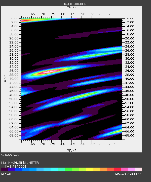
BILL Bilibino, Russia - Earthquake Result Viewer
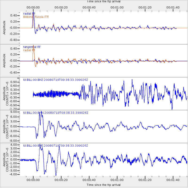
Earthquake location: Santa Cruz Islands Region
Earthquake latitude/longitude: -11.0/164.5
Earthquake time(UTC): 2008/07/19 (201) 09:27:01 GMT
Earthquake Depth: 11 km
Earthquake Magnitude: 6.1 MB, 6.4 MS, 6.6 MW, 6.6 MW
Earthquake Catalog/Contributor: WHDF/NEIC
Network: IU Global Seismograph Network (GSN - IRIS/USGS)
Station: BILL Bilibino, Russia
Lat/Lon: 68.07 N/166.45 E
Elevation: 299 m
Distance: 78.9 deg
Az: 0.75 deg
Baz: 181.96 deg
Ray Param: 0.049317844
Estimated Moho Depth: 36.25 km
Estimated Crust Vp/Vs: 1.74
Assumed Crust Vp: 6.577 km/s
Estimated Crust Vs: 3.785 km/s
Estimated Crust Poisson's Ratio: 0.25
Radial Match: 98.08538 %
Radial Bump: 398
Transverse Match: 89.75263 %
Transverse Bump: 400
SOD ConfigId: 2658
Insert Time: 2010-03-03 15:17:20.789 +0000
GWidth: 2.5
Max Bumps: 400
Tol: 0.001

Signal To Noise

ChannelStoNSTALTA
IU:BILL:00:BHN:20080719T09:38:33.399026Z49.754293.854933E-67.7479406E-8
IU:BILL:00:BHE:20080719T09:38:33.399026Z10.8945991.7334876E-61.591144E-7
IU:BILL:00:BHZ:20080719T09:38:33.399026Z1.33123661.8515894E-71.3908793E-7
Arrivals
Ps4.2 SECOND
PpPs15 SECOND
PsPs/PpSs19 SECOND