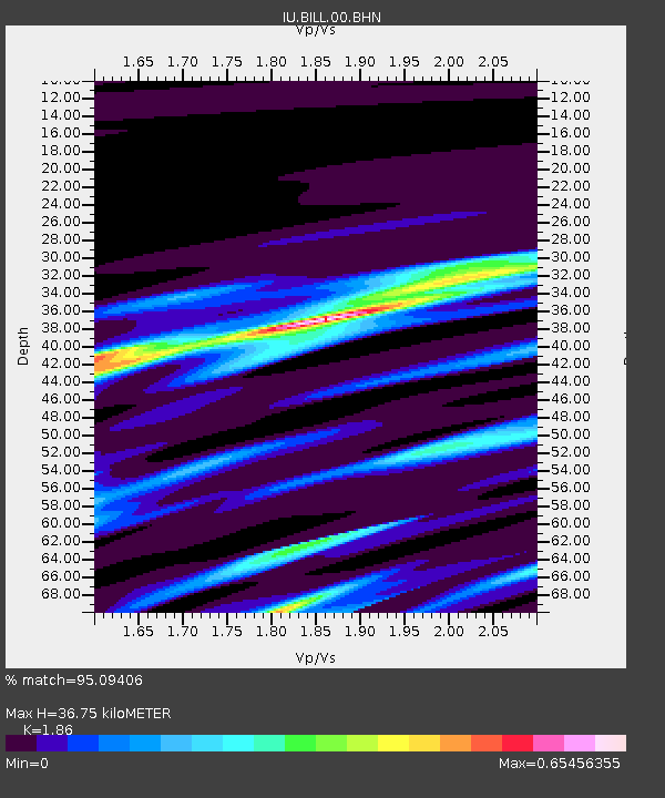
BILL Bilibino, Russia - Earthquake Result Viewer
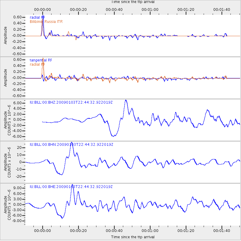
Earthquake location: Irian Jaya Region, Indonesia
Earthquake latitude/longitude: -0.7/133.3
Earthquake time(UTC): 2009/01/03 (003) 22:33:40 GMT
Earthquake Depth: 23 km
Earthquake Magnitude: 6.7 MB, 7.4 MS, 7.4 MW, 7.3 MW
Earthquake Catalog/Contributor: WHDF/NEIC
Network: IU Global Seismograph Network (GSN - IRIS/USGS)
Station: BILL Bilibino, Russia
Lat/Lon: 68.07 N/166.45 E
Elevation: 299 m
Distance: 72.3 deg
Az: 12.451 deg
Baz: 215.017 deg
Ray Param: 0.05370211
Estimated Moho Depth: 36.75 km
Estimated Crust Vp/Vs: 1.86
Assumed Crust Vp: 6.577 km/s
Estimated Crust Vs: 3.536 km/s
Estimated Crust Poisson's Ratio: 0.30
Radial Match: 95.09406 %
Radial Bump: 400
Transverse Match: 63.360947 %
Transverse Bump: 400
SOD ConfigId: 2834
Insert Time: 2010-03-03 15:17:22.046 +0000
GWidth: 2.5
Max Bumps: 400
Tol: 0.001

Signal To Noise

ChannelStoNSTALTA
IU:BILL:00:BHN:20090103T22:44:32.922019Z2.50875142.4087303E-69.601312E-7
IU:BILL:00:BHE:20090103T22:44:32.922019Z1.44789761.5173795E-61.0479881E-6
IU:BILL:00:BHZ:20090103T22:44:32.922019Z3.1301041.6603464E-65.304445E-7
Arrivals
Ps5.0 SECOND
PpPs15 SECOND
PsPs/PpSs20 SECOND