You are here: Home > Network List > GS - US Geological Survey Networks Stations List
> Station KAN13 Rinehart Farm > Earthquake Result Viewer
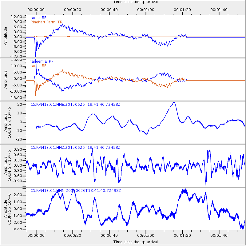
KAN13 Rinehart Farm - Earthquake Result Viewer
*The percent match for this event was below the threshold and hence no stack was calculated.
| Earthquake location: |
Kuril Islands |
| Earthquake latitude/longitude: |
44.0/146.9 |
| Earthquake time(UTC): |
2015/06/26 (177) 18:30:08 GMT |
| Earthquake Depth: |
82 km |
| Earthquake Magnitude: |
4.8 MW, 4.8 mb |
| Earthquake Catalog/Contributor: |
ISC/ISC |
|
| Network: |
GS US Geological Survey Networks |
| Station: |
KAN13 Rinehart Farm |
| Lat/Lon: |
37.01 N/97.48 W |
| Elevation: |
340 m |
|
| Distance: |
80.5 deg |
| Az: |
47.063 deg |
| Baz: |
318.707 deg |
| Ray Param: |
$rayparam |
*The percent match for this event was below the threshold and hence was not used in the summary stack. |
|
| Radial Match: |
53.271927 % |
| Radial Bump: |
400 |
| Transverse Match: |
61.049137 % |
| Transverse Bump: |
400 |
| SOD ConfigId: |
7422571 |
| Insert Time: |
2019-04-19 12:22:06.482 +0000 |
| GWidth: |
2.5 |
| Max Bumps: |
400 |
| Tol: |
0.001 |
|
Signal To Noise
| Channel | StoN | STA | LTA |
| GS:KAN13:01:HHZ:20150626T18:41:40.72498Z | 0.8519484 | 2.2619709E-7 | 2.6550563E-7 |
| GS:KAN13:01:HHN:20150626T18:41:40.72498Z | 0.2490502 | 2.680437E-7 | 1.0762637E-6 |
| GS:KAN13:01:HHE:20150626T18:41:40.72498Z | 6.2637696 | 1.2461391E-5 | 1.9894396E-6 |
| Arrivals |
| Ps | |
| PpPs | |
| PsPs/PpSs | |


