You are here: Home > Network List > TA - USArray Transportable Network (new EarthScope stations) Stations List
> Station I61A Oroboro, Fairlee, VT, USA > Earthquake Result Viewer
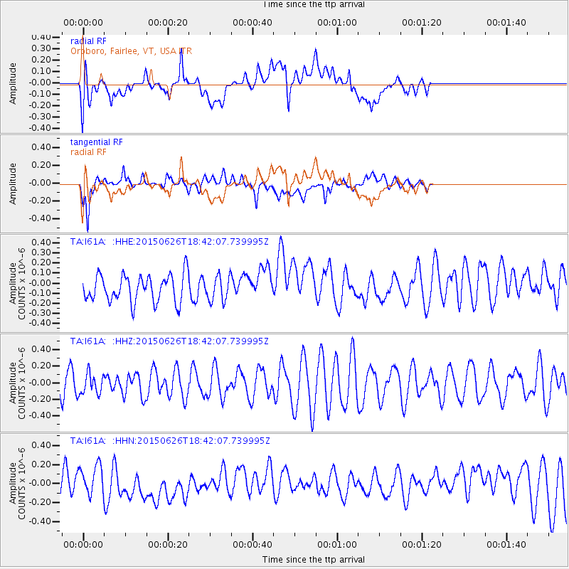
I61A Oroboro, Fairlee, VT, USA - Earthquake Result Viewer
*The percent match for this event was below the threshold and hence no stack was calculated.
| Earthquake location: |
Kuril Islands |
| Earthquake latitude/longitude: |
44.0/146.9 |
| Earthquake time(UTC): |
2015/06/26 (177) 18:30:08 GMT |
| Earthquake Depth: |
82 km |
| Earthquake Magnitude: |
4.8 MW, 4.8 mb |
| Earthquake Catalog/Contributor: |
ISC/ISC |
|
| Network: |
TA USArray Transportable Network (new EarthScope stations) |
| Station: |
I61A Oroboro, Fairlee, VT, USA |
| Lat/Lon: |
43.93 N/72.21 W |
| Elevation: |
287 m |
|
| Distance: |
85.7 deg |
| Az: |
27.221 deg |
| Baz: |
332.819 deg |
| Ray Param: |
$rayparam |
*The percent match for this event was below the threshold and hence was not used in the summary stack. |
|
| Radial Match: |
34.362007 % |
| Radial Bump: |
400 |
| Transverse Match: |
70.16711 % |
| Transverse Bump: |
400 |
| SOD ConfigId: |
7422571 |
| Insert Time: |
2019-04-19 12:25:19.647 +0000 |
| GWidth: |
2.5 |
| Max Bumps: |
400 |
| Tol: |
0.001 |
|
Signal To Noise
| Channel | StoN | STA | LTA |
| TA:I61A: :HHZ:20150626T18:42:07.739995Z | 0.82639027 | 1.2117854E-7 | 1.4663597E-7 |
| TA:I61A: :HHN:20150626T18:42:07.739995Z | 1.4163066 | 1.4758511E-7 | 1.0420422E-7 |
| TA:I61A: :HHE:20150626T18:42:07.739995Z | 0.9223059 | 1.2334176E-7 | 1.3373194E-7 |
| Arrivals |
| Ps | |
| PpPs | |
| PsPs/PpSs | |


