You are here: Home > Network List > TA - USArray Transportable Network (new EarthScope stations) Stations List
> Station R11A Troy Canyon, Currant, NV, USA > Earthquake Result Viewer
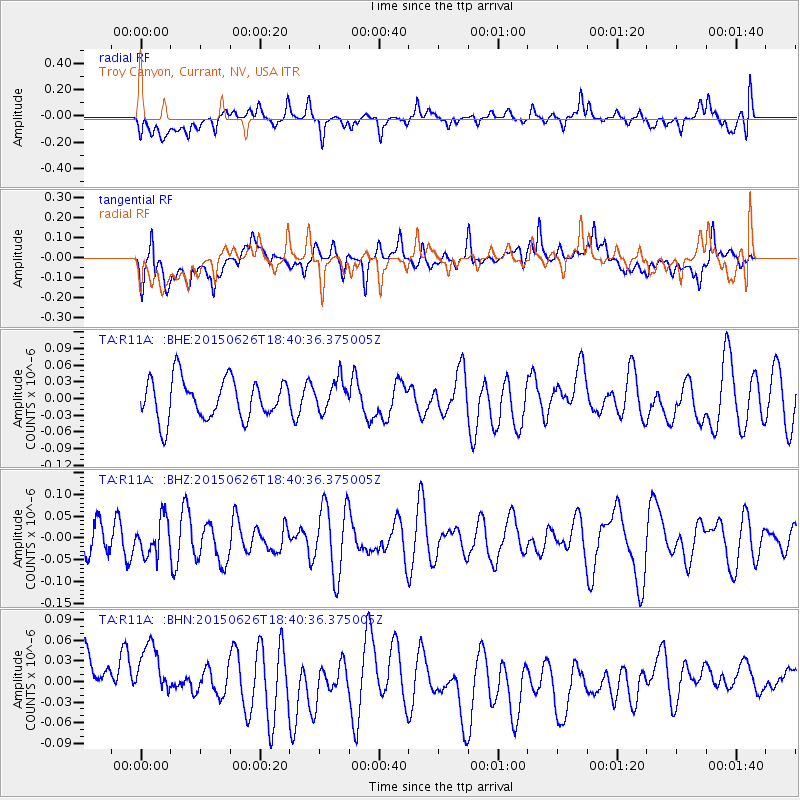
R11A Troy Canyon, Currant, NV, USA - Earthquake Result Viewer
*The percent match for this event was below the threshold and hence no stack was calculated.
| Earthquake location: |
Kuril Islands |
| Earthquake latitude/longitude: |
44.0/146.9 |
| Earthquake time(UTC): |
2015/06/26 (177) 18:30:08 GMT |
| Earthquake Depth: |
82 km |
| Earthquake Magnitude: |
4.8 MW, 4.8 mb |
| Earthquake Catalog/Contributor: |
ISC/ISC |
|
| Network: |
TA USArray Transportable Network (new EarthScope stations) |
| Station: |
R11A Troy Canyon, Currant, NV, USA |
| Lat/Lon: |
38.35 N/115.59 W |
| Elevation: |
1756 m |
|
| Distance: |
69.3 deg |
| Az: |
56.469 deg |
| Baz: |
310.099 deg |
| Ray Param: |
$rayparam |
*The percent match for this event was below the threshold and hence was not used in the summary stack. |
|
| Radial Match: |
44.340748 % |
| Radial Bump: |
400 |
| Transverse Match: |
42.646267 % |
| Transverse Bump: |
400 |
| SOD ConfigId: |
7422571 |
| Insert Time: |
2019-04-19 12:25:33.992 +0000 |
| GWidth: |
2.5 |
| Max Bumps: |
400 |
| Tol: |
0.001 |
|
Signal To Noise
| Channel | StoN | STA | LTA |
| TA:R11A: :BHZ:20150626T18:40:36.375005Z | 1.1794424 | 4.1087866E-8 | 3.4836688E-8 |
| TA:R11A: :BHN:20150626T18:40:36.375005Z | 0.9207303 | 4.7189584E-8 | 5.125234E-8 |
| TA:R11A: :BHE:20150626T18:40:36.375005Z | 0.79158604 | 2.8363852E-8 | 3.5831672E-8 |
| Arrivals |
| Ps | |
| PpPs | |
| PsPs/PpSs | |


