TAM Tamanrasset, Algeria - Earthquake Result Viewer
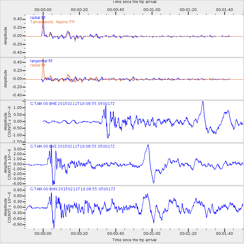
Earthquake location: Jujuy Province, Argentina
Earthquake latitude/longitude: -23.1/-66.7
Earthquake time(UTC): 2015/02/11 (042) 18:57:22 GMT
Earthquake Depth: 223 km
Earthquake Magnitude: 6.7 MWW, 6.7 MWC, 6.7 MWB, 6.9 MI
Earthquake Catalog/Contributor: NEIC PDE/NEIC COMCAT
Network: G GEOSCOPE
Station: TAM Tamanrasset, Algeria
Lat/Lon: 22.79 N/5.53 E
Elevation: 1377 m
Distance: 83.7 deg
Az: 62.134 deg
Baz: 241.886 deg
Ray Param: 0.04543828
Estimated Moho Depth: 33.5 km
Estimated Crust Vp/Vs: 1.78
Assumed Crust Vp: 6.61 km/s
Estimated Crust Vs: 3.713 km/s
Estimated Crust Poisson's Ratio: 0.27
Radial Match: 96.89127 %
Radial Bump: 287
Transverse Match: 78.092384 %
Transverse Bump: 400
SOD ConfigId: 872571
Insert Time: 2015-02-25 19:01:06.468 +0000
GWidth: 2.5
Max Bumps: 400
Tol: 0.001

Signal To Noise

ChannelStoNSTALTA
G:TAM:00:BHZ:20150211T19:08:55.050017Z13.9240511.254609E-69.0103725E-8
G:TAM:00:BHN:20150211T19:08:55.050017Z3.35096762.6072246E-77.780512E-8
G:TAM:00:BHE:20150211T19:08:55.050017Z6.31286434.0589563E-76.4296586E-8
Arrivals
Ps4.1 SECOND
PpPs14 SECOND
PsPs/PpSs18 SECOND