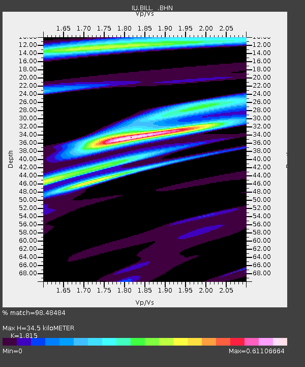
BILL Bilibino, Russia - Earthquake Result Viewer
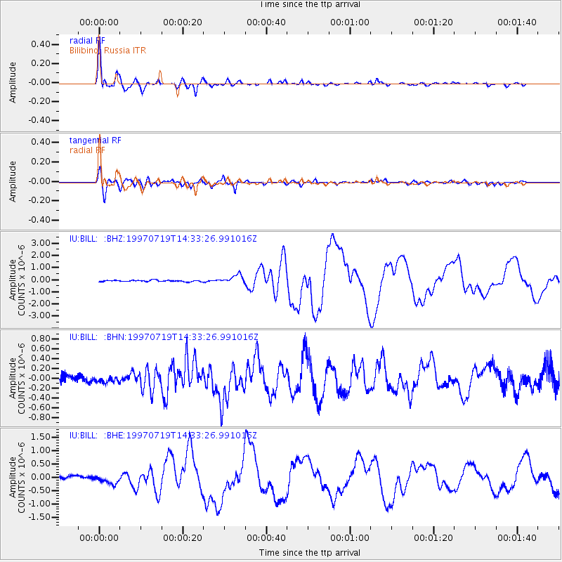
Earthquake location: Near Coast Of Guerrero, Mexico
Earthquake latitude/longitude: 16.3/-98.2
Earthquake time(UTC): 1997/07/19 (200) 14:22:08 GMT
Earthquake Depth: 33 km
Earthquake Magnitude: 5.7 MB, 6.3 MS, 6.8 UNKNOWN, 6.0 ME
Earthquake Catalog/Contributor: WHDF/NEIC
Network: IU Global Seismograph Network (GSN - IRIS/USGS)
Station: BILL Bilibino, Russia
Lat/Lon: 68.07 N/166.45 E
Elevation: 299 m
Distance: 77.0 deg
Az: 337.42 deg
Baz: 78.893 deg
Ray Param: 0.050592113
Estimated Moho Depth: 34.5 km
Estimated Crust Vp/Vs: 1.82
Assumed Crust Vp: 6.577 km/s
Estimated Crust Vs: 3.624 km/s
Estimated Crust Poisson's Ratio: 0.28
Radial Match: 98.48484 %
Radial Bump: 400
Transverse Match: 91.74497 %
Transverse Bump: 400
SOD ConfigId: 6273
Insert Time: 2010-03-03 15:18:19.903 +0000
GWidth: 2.5
Max Bumps: 400
Tol: 0.001

Signal To Noise

ChannelStoNSTALTA
IU:BILL: :BHN:19970719T14:33:26.991016Z0.78529846.284951E-88.003264E-8
IU:BILL: :BHE:19970719T14:33:26.991016Z2.6779061.6210915E-76.053578E-8
IU:BILL: :BHZ:19970719T14:33:26.991016Z6.38733053.512123E-75.498577E-8
Arrivals
Ps4.4 SECOND
PpPs14 SECOND
PsPs/PpSs19 SECOND