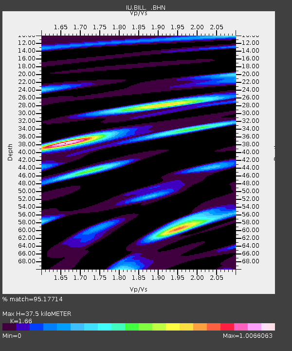
BILL Bilibino, Russia - Earthquake Result Viewer
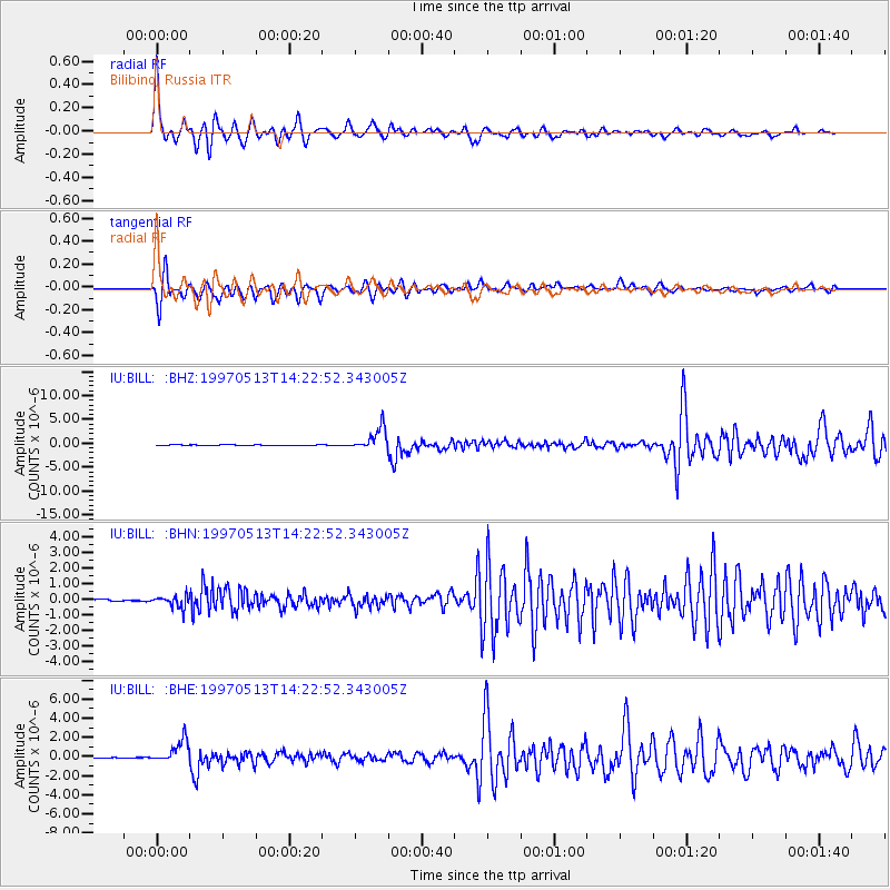
Earthquake location: Hindu Kush Region, Afghanistan
Earthquake latitude/longitude: 36.4/70.9
Earthquake time(UTC): 1997/05/13 (133) 14:13:45 GMT
Earthquake Depth: 196 km
Earthquake Magnitude: 6.1 MB, 6.5 UNKNOWN, 6.4 MW
Earthquake Catalog/Contributor: WHDF/NEIC
Network: IU Global Seismograph Network (GSN - IRIS/USGS)
Station: BILL Bilibino, Russia
Lat/Lon: 68.07 N/166.45 E
Elevation: 299 m
Distance: 58.8 deg
Az: 25.938 deg
Baz: 290.097 deg
Ray Param: 0.061993796
Estimated Moho Depth: 37.5 km
Estimated Crust Vp/Vs: 1.66
Assumed Crust Vp: 6.577 km/s
Estimated Crust Vs: 3.962 km/s
Estimated Crust Poisson's Ratio: 0.22
Radial Match: 95.17714 %
Radial Bump: 400
Transverse Match: 93.79897 %
Transverse Bump: 400
SOD ConfigId: 6273
Insert Time: 2010-03-03 15:18:41.047 +0000
GWidth: 2.5
Max Bumps: 400
Tol: 0.001

Signal To Noise

ChannelStoNSTALTA
IU:BILL: :BHN:19970513T14:22:52.343005Z2.84053.8815466E-71.3665012E-7
IU:BILL: :BHE:19970513T14:22:52.343005Z27.1436731.1867597E-64.3721414E-8
IU:BILL: :BHZ:19970513T14:22:52.343005Z50.0665252.3249092E-64.64364E-8
Arrivals
Ps4.0 SECOND
PpPs14 SECOND
PsPs/PpSs18 SECOND