LBTB Lobatse, Botswana, Africa - Earthquake Result Viewer
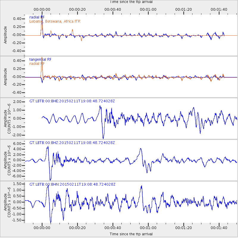
Earthquake location: Jujuy Province, Argentina
Earthquake latitude/longitude: -23.1/-66.7
Earthquake time(UTC): 2015/02/11 (042) 18:57:22 GMT
Earthquake Depth: 223 km
Earthquake Magnitude: 6.7 MWW, 6.7 MWC, 6.7 MWB, 6.9 MI
Earthquake Catalog/Contributor: NEIC PDE/NEIC COMCAT
Network: GT Global Telemetered Seismograph Network (USAF/USGS)
Station: LBTB Lobatse, Botswana, Africa
Lat/Lon: 25.02 S/25.60 E
Elevation: 1128 m
Distance: 82.5 deg
Az: 113.878 deg
Baz: 248.118 deg
Ray Param: 0.04630575
Estimated Moho Depth: 15.5 km
Estimated Crust Vp/Vs: 2.10
Assumed Crust Vp: 6.459 km/s
Estimated Crust Vs: 3.083 km/s
Estimated Crust Poisson's Ratio: 0.35
Radial Match: 86.893974 %
Radial Bump: 290
Transverse Match: 52.977695 %
Transverse Bump: 272
SOD ConfigId: 872571
Insert Time: 2015-02-25 19:02:21.583 +0000
GWidth: 2.5
Max Bumps: 400
Tol: 0.001

Signal To Noise

ChannelStoNSTALTA
GT:LBTB:00:BHZ:20150211T19:08:48.724028Z6.40837343.0882825E-64.819136E-7
GT:LBTB:00:BHN:20150211T19:08:48.724028Z2.71480927.3339737E-72.7014693E-7
GT:LBTB:00:BHE:20150211T19:08:48.724028Z3.33461211.0252663E-63.0746193E-7
Arrivals
Ps2.7 SECOND
PpPs7.3 SECOND
PsPs/PpSs10.0 SECOND