You are here: Home > Network List > TA - USArray Transportable Network (new EarthScope stations) Stations List
> Station J01E Myrtle Point, OR, USA > Earthquake Result Viewer
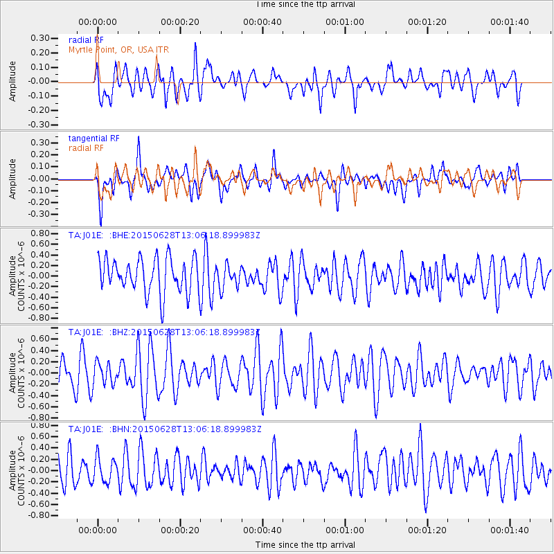
J01E Myrtle Point, OR, USA - Earthquake Result Viewer
*The percent match for this event was below the threshold and hence no stack was calculated.
| Earthquake location: |
South Of Kermadec Islands |
| Earthquake latitude/longitude: |
-32.2/-178.3 |
| Earthquake time(UTC): |
2015/06/28 (179) 12:53:50 GMT |
| Earthquake Depth: |
10 km |
| Earthquake Magnitude: |
5.1 MW, 5.1 mb, 4.8 MS |
| Earthquake Catalog/Contributor: |
ISC/ISC |
|
| Network: |
TA USArray Transportable Network (new EarthScope stations) |
| Station: |
J01E Myrtle Point, OR, USA |
| Lat/Lon: |
43.16 N/123.93 W |
| Elevation: |
128 m |
|
| Distance: |
90.0 deg |
| Az: |
36.496 deg |
| Baz: |
223.542 deg |
| Ray Param: |
$rayparam |
*The percent match for this event was below the threshold and hence was not used in the summary stack. |
|
| Radial Match: |
46.67259 % |
| Radial Bump: |
400 |
| Transverse Match: |
47.18295 % |
| Transverse Bump: |
400 |
| SOD ConfigId: |
7422571 |
| Insert Time: |
2019-04-19 12:46:04.009 +0000 |
| GWidth: |
2.5 |
| Max Bumps: |
400 |
| Tol: |
0.001 |
|
Signal To Noise
| Channel | StoN | STA | LTA |
| TA:J01E: :BHZ:20150628T13:06:18.899983Z | 0.61724687 | 1.7910268E-7 | 2.9016377E-7 |
| TA:J01E: :BHN:20150628T13:06:18.899983Z | 0.85297906 | 2.2919465E-7 | 2.6869904E-7 |
| TA:J01E: :BHE:20150628T13:06:18.899983Z | 0.65245664 | 2.1228344E-7 | 3.2536022E-7 |
| Arrivals |
| Ps | |
| PpPs | |
| PsPs/PpSs | |


