BILL Bilibino, Russia - Earthquake Result Viewer
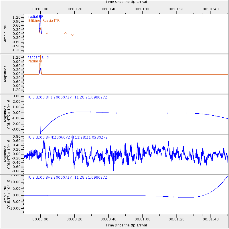
Earthquake location: Northern Sumatra, Indonesia
Earthquake latitude/longitude: 1.7/97.1
Earthquake time(UTC): 2006/07/27 (208) 11:16:40 GMT
Earthquake Depth: 20 km
Earthquake Magnitude: 5.6 MB, 6.1 MS, 6.1 MW, 6.0 MW
Earthquake Catalog/Contributor: WHDF/NEIC
Network: IU Global Seismograph Network (GSN - IRIS/USGS)
Station: BILL Bilibino, Russia
Lat/Lon: 68.07 N/166.45 E
Elevation: 299 m
Distance: 80.8 deg
Az: 20.859 deg
Baz: 251.316 deg
Ray Param: 0.048023235
Estimated Moho Depth: 10.0 km
Estimated Crust Vp/Vs: 1.60
Assumed Crust Vp: 6.577 km/s
Estimated Crust Vs: 4.11 km/s
Estimated Crust Poisson's Ratio: 0.18
Radial Match: 99.999664 %
Radial Bump: 2
Transverse Match: 99.976265 %
Transverse Bump: 4
SOD ConfigId: 2665
Insert Time: 2010-03-03 15:20:56.071 +0000
GWidth: 2.5
Max Bumps: 400
Tol: 0.001

Signal To Noise

ChannelStoNSTALTA
IU:BILL:00:BHN:20060727T11:28:21.098027Z1.58291983.3729177E-72.1308203E-7
IU:BILL:00:BHE:20060727T11:28:21.098027Z0.91204031.124109E-61.2325213E-6
IU:BILL:00:BHZ:20060727T11:28:21.098027Z0.91054671.031513E-61.1328502E-6
Arrivals
Ps0.9 SECOND
PpPs3.8 SECOND
PsPs/PpSs4.8 SECOND