BILL Bilibino, Russia - Earthquake Result Viewer
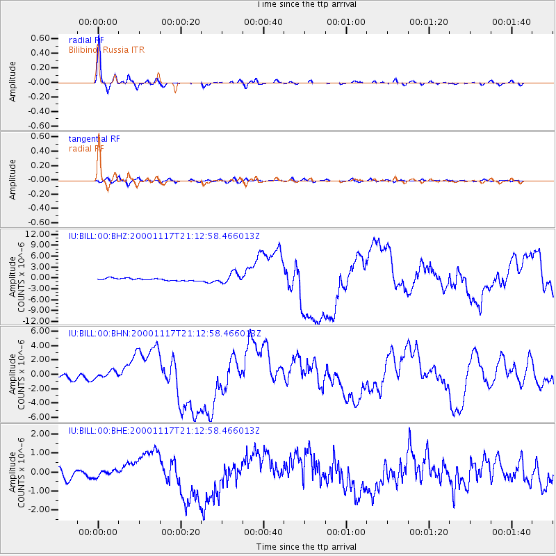
Earthquake location: New Britain Region, P.N.G.
Earthquake latitude/longitude: -5.5/151.8
Earthquake time(UTC): 2000/11/17 (322) 21:01:56 GMT
Earthquake Depth: 33 km
Earthquake Magnitude: 6.2 MB, 8.0 MS, 7.6 MW, 6.9 ME
Earthquake Catalog/Contributor: WHDF/NEIC
Network: IU Global Seismograph Network (GSN - IRIS/USGS)
Station: BILL Bilibino, Russia
Lat/Lon: 68.07 N/166.45 E
Elevation: 299 m
Distance: 74.1 deg
Az: 5.678 deg
Baz: 195.197 deg
Ray Param: 0.052499995
Estimated Moho Depth: 27.25 km
Estimated Crust Vp/Vs: 1.97
Assumed Crust Vp: 6.577 km/s
Estimated Crust Vs: 3.334 km/s
Estimated Crust Poisson's Ratio: 0.33
Radial Match: 97.89426 %
Radial Bump: 275
Transverse Match: 77.8433 %
Transverse Bump: 400
SOD ConfigId: 3744
Insert Time: 2010-03-03 15:21:36.234 +0000
GWidth: 2.5
Max Bumps: 400
Tol: 0.001

Signal To Noise

ChannelStoNSTALTA
IU:BILL:00:BHN:20001117T21:12:58.466013Z1.56504545.2872804E-73.3783562E-7
IU:BILL:00:BHE:20001117T21:12:58.466013Z0.65798181.5923646E-72.420074E-7
IU:BILL:00:BHZ:20001117T21:12:58.466013Z4.65004351.4340586E-63.083968E-7
Arrivals
Ps4.2 SECOND
PpPs12 SECOND
PsPs/PpSs16 SECOND