You are here: Home > Network List > CN - Canadian National Seismograph Network Stations List
> Station INK INUVIK, NT > Earthquake Result Viewer
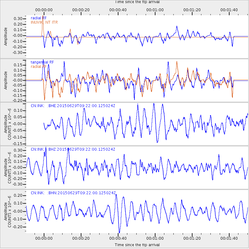
INK INUVIK, NT - Earthquake Result Viewer
*The percent match for this event was below the threshold and hence no stack was calculated.
| Earthquake location: |
Near Coast Of Peru |
| Earthquake latitude/longitude: |
-16.0/-74.2 |
| Earthquake time(UTC): |
2015/06/29 (180) 09:09:15 GMT |
| Earthquake Depth: |
24 km |
| Earthquake Magnitude: |
5.5 MB |
| Earthquake Catalog/Contributor: |
NEIC PDE/NEIC ALERT |
|
| Network: |
CN Canadian National Seismograph Network |
| Station: |
INK INUVIK, NT |
| Lat/Lon: |
68.31 N/133.53 W |
| Elevation: |
44 m |
|
| Distance: |
94.1 deg |
| Az: |
341.303 deg |
| Baz: |
123.985 deg |
| Ray Param: |
$rayparam |
*The percent match for this event was below the threshold and hence was not used in the summary stack. |
|
| Radial Match: |
67.32414 % |
| Radial Bump: |
400 |
| Transverse Match: |
50.28012 % |
| Transverse Bump: |
384 |
| SOD ConfigId: |
7422571 |
| Insert Time: |
2019-04-19 13:02:12.136 +0000 |
| GWidth: |
2.5 |
| Max Bumps: |
400 |
| Tol: |
0.001 |
|
Signal To Noise
| Channel | StoN | STA | LTA |
| CN:INK: :BHZ:20150629T09:22:00.125024Z | 1.7418897 | 1.7765491E-7 | 1.0198976E-7 |
| CN:INK: :BHN:20150629T09:22:00.125024Z | 0.7589373 | 6.493582E-8 | 8.556151E-8 |
| CN:INK: :BHE:20150629T09:22:00.125024Z | 0.45721078 | 2.2576577E-8 | 4.9378926E-8 |
| Arrivals |
| Ps | |
| PpPs | |
| PsPs/PpSs | |


