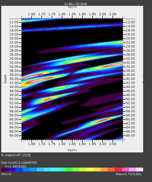
BILL Bilibino, Russia - Earthquake Result Viewer
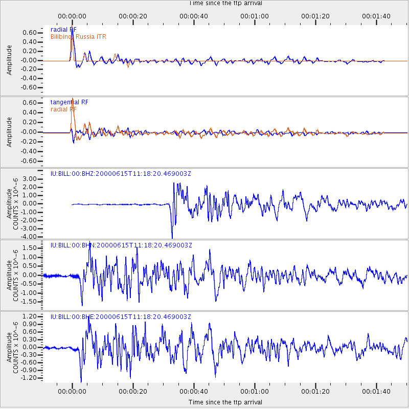
Earthquake location: Southeast Of Shikoku, Japan
Earthquake latitude/longitude: 29.4/132.1
Earthquake time(UTC): 2000/06/15 (167) 11:10:46 GMT
Earthquake Depth: 10 km
Earthquake Magnitude: 6.0 MB, 5.6 MS, 6.1 MW, 6.1 MW
Earthquake Catalog/Contributor: WHDF/NEIC
Network: IU Global Seismograph Network (GSN - IRIS/USGS)
Station: BILL Bilibino, Russia
Lat/Lon: 68.07 N/166.45 E
Elevation: 299 m
Distance: 43.7 deg
Az: 17.876 deg
Baz: 225.492 deg
Ray Param: 0.072377026
Estimated Moho Depth: 40.5 km
Estimated Crust Vp/Vs: 1.68
Assumed Crust Vp: 6.577 km/s
Estimated Crust Vs: 3.915 km/s
Estimated Crust Poisson's Ratio: 0.23
Radial Match: 97.2326 %
Radial Bump: 359
Transverse Match: 88.00452 %
Transverse Bump: 400
SOD ConfigId: 3744
Insert Time: 2010-03-03 15:22:28.635 +0000
GWidth: 2.5
Max Bumps: 400
Tol: 0.001

Signal To Noise

ChannelStoNSTALTA
IU:BILL:00:BHN:20000615T11:18:20.469003Z8.0860464.847051E-75.99434E-8
IU:BILL:00:BHE:20000615T11:18:20.469003Z13.2803034.3489877E-73.2747653E-8
IU:BILL:00:BHZ:20000615T11:18:20.469003Z48.8517231.4860124E-63.0418832E-8
Arrivals
Ps4.5 SECOND
PpPs15 SECOND
PsPs/PpSs20 SECOND