
BILL Bilibino, Russia - Earthquake Result Viewer
| ||||||||||||||||||
| ||||||||||||||||||
| ||||||||||||||||||
|
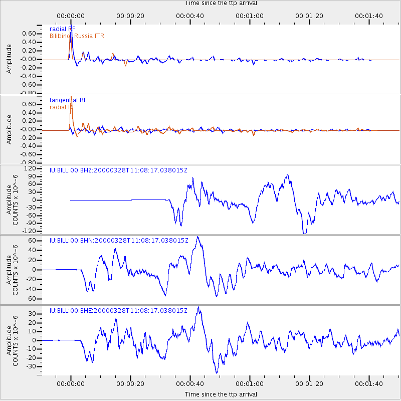
Signal To Noise
| Channel | StoN | STA | LTA |
| IU:BILL:00:BHN:20000328T11:08:17.038015Z | 11.185526 | 6.999749E-6 | 6.257863E-7 |
| IU:BILL:00:BHE:20000328T11:08:17.038015Z | 13.03945 | 4.6592345E-6 | 3.5731833E-7 |
| IU:BILL:00:BHZ:20000328T11:08:17.038015Z | 14.973088 | 1.782515E-5 | 1.1904792E-6 |
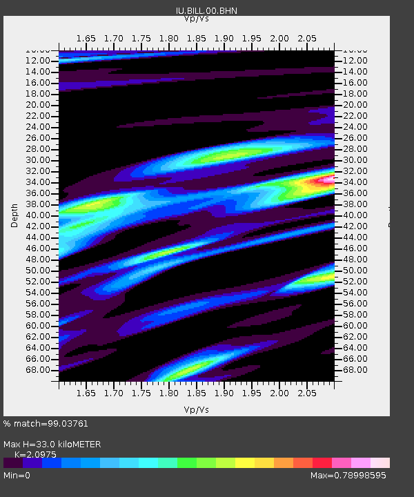
| Arrivals | |
| Ps | 5.8 SECOND |
| PpPs | 15 SECOND |
| PsPs/PpSs | 21 SECOND |

