You are here: Home > Network List > TA - USArray Transportable Network (new EarthScope stations) Stations List
> Station O03E Paynes Creek, CA, USA > Earthquake Result Viewer
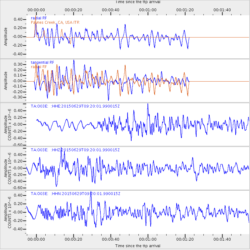
O03E Paynes Creek, CA, USA - Earthquake Result Viewer
*The percent match for this event was below the threshold and hence no stack was calculated.
| Earthquake location: |
Near Coast Of Peru |
| Earthquake latitude/longitude: |
-16.0/-74.2 |
| Earthquake time(UTC): |
2015/06/29 (180) 09:09:15 GMT |
| Earthquake Depth: |
24 km |
| Earthquake Magnitude: |
5.5 MB |
| Earthquake Catalog/Contributor: |
NEIC PDE/NEIC ALERT |
|
| Network: |
TA USArray Transportable Network (new EarthScope stations) |
| Station: |
O03E Paynes Creek, CA, USA |
| Lat/Lon: |
40.29 N/121.80 W |
| Elevation: |
967 m |
|
| Distance: |
71.4 deg |
| Az: |
323.418 deg |
| Baz: |
131.469 deg |
| Ray Param: |
$rayparam |
*The percent match for this event was below the threshold and hence was not used in the summary stack. |
|
| Radial Match: |
66.29623 % |
| Radial Bump: |
400 |
| Transverse Match: |
66.38285 % |
| Transverse Bump: |
400 |
| SOD ConfigId: |
7422571 |
| Insert Time: |
2019-04-19 13:07:32.937 +0000 |
| GWidth: |
2.5 |
| Max Bumps: |
400 |
| Tol: |
0.001 |
|
Signal To Noise
| Channel | StoN | STA | LTA |
| TA:O03E: :HHZ:20150629T09:20:01.990015Z | 2.2616699 | 1.3771228E-7 | 6.088965E-8 |
| TA:O03E: :HHN:20150629T09:20:01.990015Z | 1.6498708 | 1.03976596E-7 | 6.3021055E-8 |
| TA:O03E: :HHE:20150629T09:20:01.990015Z | 0.7520389 | 6.8921025E-8 | 9.164556E-8 |
| Arrivals |
| Ps | |
| PpPs | |
| PsPs/PpSs | |


