You are here: Home > Network List > UW - Pacific Northwest Regional Seismic Network Stations List
> Station UMAT Pilot Rock, OR, USA > Earthquake Result Viewer
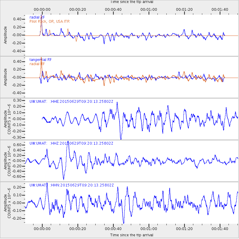
UMAT Pilot Rock, OR, USA - Earthquake Result Viewer
*The percent match for this event was below the threshold and hence no stack was calculated.
| Earthquake location: |
Near Coast Of Peru |
| Earthquake latitude/longitude: |
-16.0/-74.2 |
| Earthquake time(UTC): |
2015/06/29 (180) 09:09:15 GMT |
| Earthquake Depth: |
24 km |
| Earthquake Magnitude: |
5.5 MB |
| Earthquake Catalog/Contributor: |
NEIC PDE/NEIC ALERT |
|
| Network: |
UW Pacific Northwest Regional Seismic Network |
| Station: |
UMAT Pilot Rock, OR, USA |
| Lat/Lon: |
45.29 N/118.96 W |
| Elevation: |
1318 m |
|
| Distance: |
73.3 deg |
| Az: |
328.74 deg |
| Baz: |
135.012 deg |
| Ray Param: |
$rayparam |
*The percent match for this event was below the threshold and hence was not used in the summary stack. |
|
| Radial Match: |
74.502365 % |
| Radial Bump: |
400 |
| Transverse Match: |
71.65404 % |
| Transverse Bump: |
400 |
| SOD ConfigId: |
7422571 |
| Insert Time: |
2019-04-19 13:08:37.838 +0000 |
| GWidth: |
2.5 |
| Max Bumps: |
400 |
| Tol: |
0.001 |
|
Signal To Noise
| Channel | StoN | STA | LTA |
| UW:UMAT: :HHZ:20150629T09:20:13.25802Z | 2.0098221 | 1.8376961E-7 | 9.1435766E-8 |
| UW:UMAT: :HHN:20150629T09:20:13.25802Z | 2.050024 | 1.0812789E-7 | 5.2744696E-8 |
| UW:UMAT: :HHE:20150629T09:20:13.25802Z | 1.9713875 | 9.7720545E-8 | 4.9569426E-8 |
| Arrivals |
| Ps | |
| PpPs | |
| PsPs/PpSs | |


