MIAR Mount Ida, Arkansas, USA - Earthquake Result Viewer
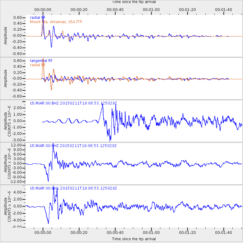
Earthquake location: Jujuy Province, Argentina
Earthquake latitude/longitude: -23.1/-66.7
Earthquake time(UTC): 2015/02/11 (042) 18:57:22 GMT
Earthquake Depth: 223 km
Earthquake Magnitude: 6.7 MWW, 6.7 MWC, 6.7 MWB, 6.9 MI
Earthquake Catalog/Contributor: NEIC PDE/NEIC COMCAT
Network: US United States National Seismic Network
Station: MIAR Mount Ida, Arkansas, USA
Lat/Lon: 34.55 N/93.58 W
Elevation: 207 m
Distance: 62.8 deg
Az: 335.178 deg
Baz: 152.078 deg
Ray Param: 0.059318464
Estimated Moho Depth: 46.75 km
Estimated Crust Vp/Vs: 1.79
Assumed Crust Vp: 6.498 km/s
Estimated Crust Vs: 3.635 km/s
Estimated Crust Poisson's Ratio: 0.27
Radial Match: 93.50743 %
Radial Bump: 400
Transverse Match: 77.708786 %
Transverse Bump: 400
SOD ConfigId: 872571
Insert Time: 2015-02-25 19:07:49.195 +0000
GWidth: 2.5
Max Bumps: 400
Tol: 0.001

Signal To Noise

ChannelStoNSTALTA
US:MIAR:00:BHZ:20150211T19:06:53.125029Z22.7905244.4035205E-61.9321716E-7
US:MIAR:00:BH1:20150211T19:06:53.125029Z10.4287291.9921838E-61.9102843E-7
US:MIAR:00:BH2:20150211T19:06:53.125029Z5.8632841.0811319E-61.8439016E-7
Arrivals
Ps5.9 SECOND
PpPs19 SECOND
PsPs/PpSs25 SECOND