BILL Bilibino, Russia - Earthquake Result Viewer
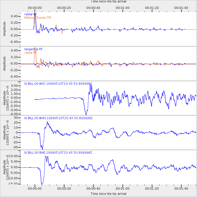
Earthquake location: New Britain Region, P.N.G.
Earthquake latitude/longitude: -5.2/150.9
Earthquake time(UTC): 1999/05/10 (130) 20:33:02 GMT
Earthquake Depth: 138 km
Earthquake Magnitude: 6.5 MB, 6.8 MS, 7.1 MW, 6.5 MB
Earthquake Catalog/Contributor: WHDF/NEIC
Network: IU Global Seismograph Network (GSN - IRIS/USGS)
Station: BILL Bilibino, Russia
Lat/Lon: 68.07 N/166.45 E
Elevation: 299 m
Distance: 73.9 deg
Az: 6.027 deg
Baz: 196.161 deg
Ray Param: 0.052359685
Estimated Moho Depth: 11.25 km
Estimated Crust Vp/Vs: 1.60
Assumed Crust Vp: 6.577 km/s
Estimated Crust Vs: 4.11 km/s
Estimated Crust Poisson's Ratio: 0.18
Radial Match: 97.96931 %
Radial Bump: 400
Transverse Match: 86.79061 %
Transverse Bump: 400
SOD ConfigId: 4480
Insert Time: 2010-03-03 15:23:48.097 +0000
GWidth: 2.5
Max Bumps: 400
Tol: 0.001

Signal To Noise

ChannelStoNSTALTA
IU:BILL:00:BHN:19990510T20:43:50.899998Z53.3887371.1744341E-52.1997786E-7
IU:BILL:00:BHE:19990510T20:43:50.899998Z17.5645145.1862903E-62.9527095E-7
IU:BILL:00:BHZ:19990510T20:43:50.899998Z11.1360821.3152568E-61.1810768E-7
Arrivals
Ps1.1 SECOND
PpPs4.3 SECOND
PsPs/PpSs5.3 SECOND