BILL Bilibino, Russia - Earthquake Result Viewer
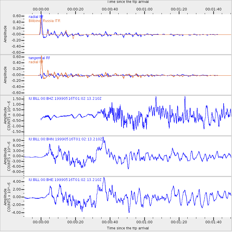
Earthquake location: New Britain Region, P.N.G.
Earthquake latitude/longitude: -4.8/152.5
Earthquake time(UTC): 1999/05/16 (136) 00:51:20 GMT
Earthquake Depth: 74 km
Earthquake Magnitude: 6.0 MB, 7.0 MS, 7.1 MW, 6.3 ME
Earthquake Catalog/Contributor: WHDF/NEIC
Network: IU Global Seismograph Network (GSN - IRIS/USGS)
Station: BILL Bilibino, Russia
Lat/Lon: 68.07 N/166.45 E
Elevation: 299 m
Distance: 73.3 deg
Az: 5.432 deg
Baz: 194.543 deg
Ray Param: 0.05292283
Estimated Moho Depth: 27.75 km
Estimated Crust Vp/Vs: 1.93
Assumed Crust Vp: 6.577 km/s
Estimated Crust Vs: 3.408 km/s
Estimated Crust Poisson's Ratio: 0.32
Radial Match: 97.95329 %
Radial Bump: 322
Transverse Match: 83.40638 %
Transverse Bump: 400
SOD ConfigId: 4480
Insert Time: 2010-03-03 15:23:53.283 +0000
GWidth: 2.5
Max Bumps: 400
Tol: 0.001

Signal To Noise

ChannelStoNSTALTA
IU:BILL:00:BHN:19990516T01:02:13.210Z11.7386161.5669796E-61.334893E-7
IU:BILL:00:BHE:19990516T01:02:13.210Z5.39005954.961686E-79.2052524E-8
IU:BILL:00:BHZ:19990516T01:02:13.210Z2.41072562.5489786E-71.05734905E-7
Arrivals
Ps4.1 SECOND
PpPs12 SECOND
PsPs/PpSs16 SECOND