You are here: Home > Network List > TA - USArray Transportable Network (new EarthScope stations) Stations List
> Station I23K Minto, Yukon-Koyukuk, AK, USA > Earthquake Result Viewer
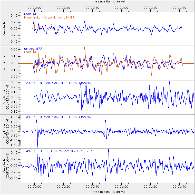
I23K Minto, Yukon-Koyukuk, AK, USA - Earthquake Result Viewer
*The percent match for this event was below the threshold and hence no stack was calculated.
| Earthquake location: |
Afghanistan-Tajikistan Bord Reg. |
| Earthquake latitude/longitude: |
36.7/71.3 |
| Earthquake time(UTC): |
2015/06/29 (180) 22:07:48 GMT |
| Earthquake Depth: |
190 km |
| Earthquake Magnitude: |
5.5 MB |
| Earthquake Catalog/Contributor: |
NEIC PDE/NEIC ALERT |
|
| Network: |
TA USArray Transportable Network (new EarthScope stations) |
| Station: |
I23K Minto, Yukon-Koyukuk, AK, USA |
| Lat/Lon: |
65.15 N/149.36 W |
| Elevation: |
149 m |
|
| Distance: |
73.7 deg |
| Az: |
16.67 deg |
| Baz: |
326.935 deg |
| Ray Param: |
$rayparam |
*The percent match for this event was below the threshold and hence was not used in the summary stack. |
|
| Radial Match: |
74.07381 % |
| Radial Bump: |
400 |
| Transverse Match: |
59.605904 % |
| Transverse Bump: |
400 |
| SOD ConfigId: |
7422571 |
| Insert Time: |
2019-04-19 13:15:42.493 +0000 |
| GWidth: |
2.5 |
| Max Bumps: |
400 |
| Tol: |
0.001 |
|
Signal To Noise
| Channel | StoN | STA | LTA |
| TA:I23K: :BHZ:20150629T22:18:29.349976Z | 13.198274 | 6.1982354E-7 | 4.696247E-8 |
| TA:I23K: :BHN:20150629T22:18:29.349976Z | 2.8917904 | 1.5595553E-7 | 5.393044E-8 |
| TA:I23K: :BHE:20150629T22:18:29.349976Z | 2.2013426 | 1.3942322E-7 | 6.3335534E-8 |
| Arrivals |
| Ps | |
| PpPs | |
| PsPs/PpSs | |


