You are here: Home > Network List > UW - Pacific Northwest Regional Seismic Network Stations List
> Station MRBL Marblemount, WA, USA > Earthquake Result Viewer
MRBL Marblemount, WA, USA - Earthquake Result Viewer
*The percent match for this event was below the threshold and hence no stack was calculated.
| Earthquake location: |
New Britain Region, P.N.G. |
| Earthquake latitude/longitude: |
-5.5/151.6 |
| Earthquake time(UTC): |
2015/06/30 (181) 03:39:28 GMT |
| Earthquake Depth: |
35 km |
| Earthquake Magnitude: |
5.8 MB |
| Earthquake Catalog/Contributor: |
NEIC PDE/NEIC ALERT |
|
| Network: |
UW Pacific Northwest Regional Seismic Network |
| Station: |
MRBL Marblemount, WA, USA |
| Lat/Lon: |
48.52 N/121.48 W |
| Elevation: |
75 m |
|
| Distance: |
92.0 deg |
| Az: |
41.629 deg |
| Baz: |
264.085 deg |
| Ray Param: |
$rayparam |
*The percent match for this event was below the threshold and hence was not used in the summary stack. |
|
| Radial Match: |
66.31021 % |
| Radial Bump: |
400 |
| Transverse Match: |
56.79273 % |
| Transverse Bump: |
400 |
| SOD ConfigId: |
7422571 |
| Insert Time: |
2019-04-19 13:24:49.472 +0000 |
| GWidth: |
2.5 |
| Max Bumps: |
400 |
| Tol: |
0.001 |
|
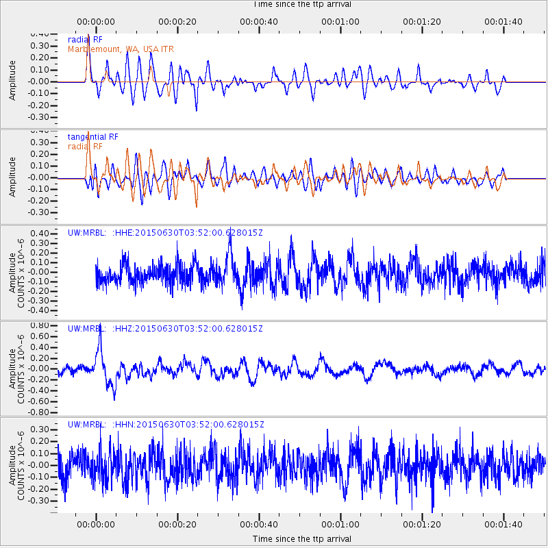
Signal To Noise
| Channel | StoN | STA | LTA |
| UW:MRBL: :HHZ:20150630T03:52:00.628015Z | 6.1469216 | 3.4222714E-7 | 5.567456E-8 |
| UW:MRBL: :HHN:20150630T03:52:00.628015Z | 1.2713864 | 1.24132E-7 | 9.763516E-8 |
| UW:MRBL: :HHE:20150630T03:52:00.628015Z | 1.9206058 | 1.8429698E-7 | 9.595774E-8 |
| Arrivals |
| Ps | |
| PpPs | |
| PsPs/PpSs | |


