You are here: Home > Network List > UW - Pacific Northwest Regional Seismic Network Stations List
> Station UMAT Pilot Rock, OR, USA > Earthquake Result Viewer
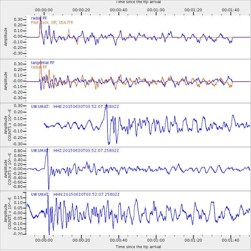
UMAT Pilot Rock, OR, USA - Earthquake Result Viewer
*The percent match for this event was below the threshold and hence no stack was calculated.
| Earthquake location: |
New Britain Region, P.N.G. |
| Earthquake latitude/longitude: |
-5.5/151.6 |
| Earthquake time(UTC): |
2015/06/30 (181) 03:39:28 GMT |
| Earthquake Depth: |
35 km |
| Earthquake Magnitude: |
5.8 MB |
| Earthquake Catalog/Contributor: |
NEIC PDE/NEIC ALERT |
|
| Network: |
UW Pacific Northwest Regional Seismic Network |
| Station: |
UMAT Pilot Rock, OR, USA |
| Lat/Lon: |
45.29 N/118.96 W |
| Elevation: |
1318 m |
|
| Distance: |
93.4 deg |
| Az: |
45.002 deg |
| Baz: |
265.764 deg |
| Ray Param: |
$rayparam |
*The percent match for this event was below the threshold and hence was not used in the summary stack. |
|
| Radial Match: |
72.28497 % |
| Radial Bump: |
359 |
| Transverse Match: |
62.693855 % |
| Transverse Bump: |
400 |
| SOD ConfigId: |
7422571 |
| Insert Time: |
2019-04-19 13:24:56.364 +0000 |
| GWidth: |
2.5 |
| Max Bumps: |
400 |
| Tol: |
0.001 |
|
Signal To Noise
| Channel | StoN | STA | LTA |
| UW:UMAT: :HHZ:20150630T03:52:07.25802Z | 10.079347 | 4.419254E-7 | 4.384465E-8 |
| UW:UMAT: :HHN:20150630T03:52:07.25802Z | 1.5746872 | 7.488384E-8 | 4.7554742E-8 |
| UW:UMAT: :HHE:20150630T03:52:07.25802Z | 5.629744 | 1.9153352E-7 | 3.402171E-8 |
| Arrivals |
| Ps | |
| PpPs | |
| PsPs/PpSs | |


