
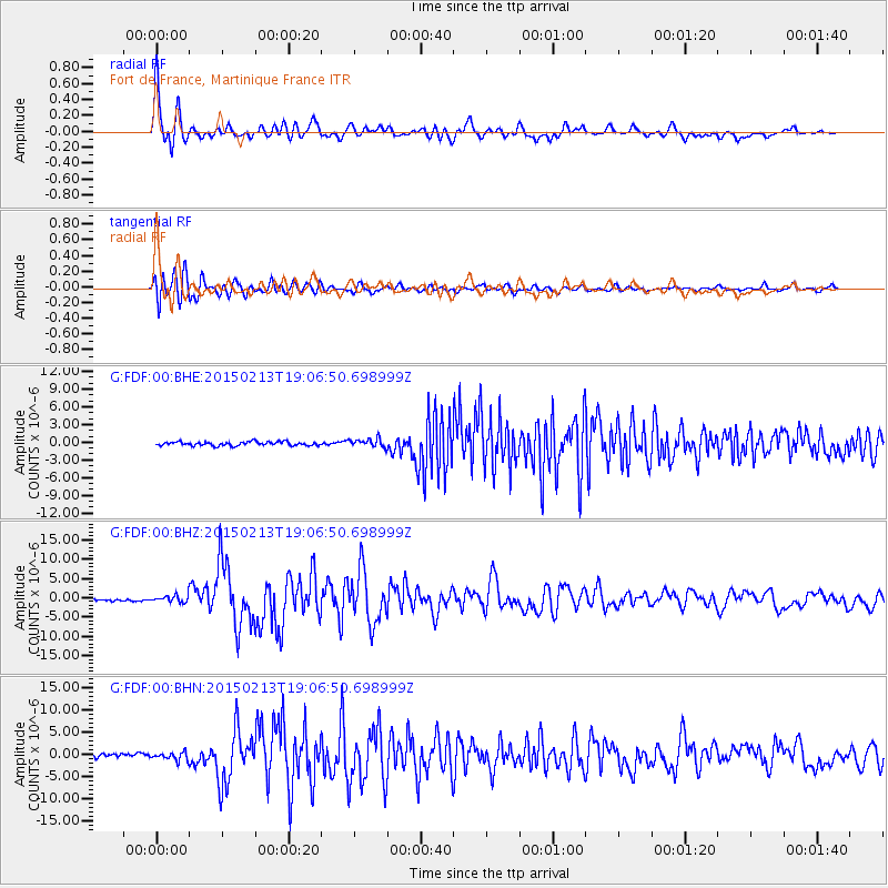
FDF Fort de France, Martinique France - Earthquake Result Viewer
| ||||||||||||||||||
| ||||||||||||||||||
| ||||||||||||||||||
|
Signal To Noise
| Channel | StoN | STA | LTA |
| G:FDF:00:BHZ:20150213T19:06:50.698999Z | 3.2799187 | 8.839838E-7 | 2.6951392E-7 |
| G:FDF:00:BHN:20150213T19:06:50.698999Z | 2.2737966 | 8.9683795E-7 | 3.9442313E-7 |
| G:FDF:00:BHE:20150213T19:06:50.698999Z | 2.1883845 | 7.0828975E-7 | 3.2365872E-7 |
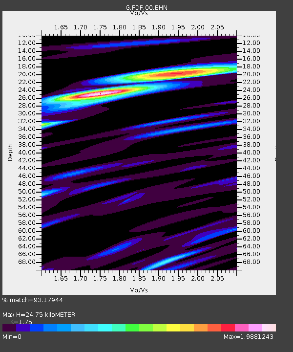
| Arrivals | |
| Ps | 3.3 SECOND |
| PpPs | 11 SECOND |
| PsPs/PpSs | 14 SECOND |

