You are here: Home > Network List > IU - Global Seismograph Network (GSN - IRIS/USGS) Stations List
> Station BILL Bilibino, Russia > Earthquake Result Viewer
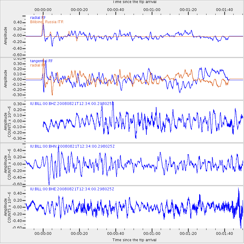
BILL Bilibino, Russia - Earthquake Result Viewer
*The percent match for this event was below the threshold and hence no stack was calculated.
| Earthquake location: |
Myanmar-China Border Region |
| Earthquake latitude/longitude: |
25.0/97.7 |
| Earthquake time(UTC): |
2008/08/21 (234) 12:24:29 GMT |
| Earthquake Depth: |
1.0 km |
| Earthquake Magnitude: |
5.6 MB, 5.9 MS, 6.0 MW, 6.0 MW |
| Earthquake Catalog/Contributor: |
WHDF/NEIC |
|
| Network: |
IU Global Seismograph Network (GSN - IRIS/USGS) |
| Station: |
BILL Bilibino, Russia |
| Lat/Lon: |
68.07 N/166.45 E |
| Elevation: |
299 m |
|
| Distance: |
59.1 deg |
| Az: |
24.089 deg |
| Baz: |
260.187 deg |
| Ray Param: |
$rayparam |
*The percent match for this event was below the threshold and hence was not used in the summary stack. |
|
| Radial Match: |
62.102585 % |
| Radial Bump: |
400 |
| Transverse Match: |
61.98497 % |
| Transverse Bump: |
400 |
| SOD ConfigId: |
2504 |
| Insert Time: |
2010-03-03 15:26:54.527 +0000 |
| GWidth: |
2.5 |
| Max Bumps: |
400 |
| Tol: |
0.001 |
|
Signal To Noise
| Channel | StoN | STA | LTA |
| IU:BILL:00:BHN:20080821T12:34:00.298025Z | 2.9836142 | 2.4714856E-7 | 8.28353E-8 |
| IU:BILL:00:BHE:20080821T12:34:00.298025Z | 0.87442726 | 1.0878575E-7 | 1.24408E-7 |
| IU:BILL:00:BHZ:20080821T12:34:00.298025Z | 1.9680002 | 1.284249E-7 | 6.525655E-8 |
| Arrivals |
| Ps | |
| PpPs | |
| PsPs/PpSs | |


