You are here: Home > Network List > IU - Global Seismograph Network (GSN - IRIS/USGS) Stations List
> Station BILL Bilibino, Russia > Earthquake Result Viewer
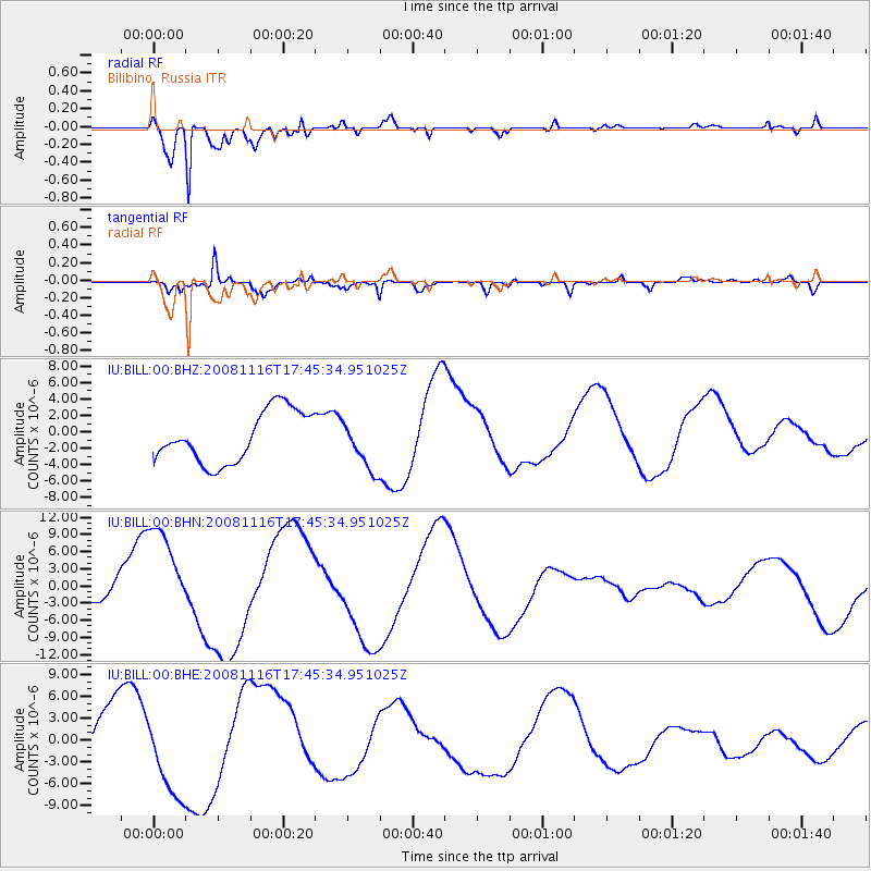
BILL Bilibino, Russia - Earthquake Result Viewer
*The percent match for this event was below the threshold and hence no stack was calculated.
| Earthquake location: |
Minahassa Peninsula, Sulawesi |
| Earthquake latitude/longitude: |
1.3/122.1 |
| Earthquake time(UTC): |
2008/11/16 (321) 17:34:38 GMT |
| Earthquake Depth: |
35 km |
| Earthquake Magnitude: |
5.6 MB |
| Earthquake Catalog/Contributor: |
WHDF/NEIC |
|
| Network: |
IU Global Seismograph Network (GSN - IRIS/USGS) |
| Station: |
BILL Bilibino, Russia |
| Lat/Lon: |
68.07 N/166.45 E |
| Elevation: |
299 m |
|
| Distance: |
73.2 deg |
| Az: |
15.924 deg |
| Baz: |
226.891 deg |
| Ray Param: |
$rayparam |
*The percent match for this event was below the threshold and hence was not used in the summary stack. |
|
| Radial Match: |
84.8818 % |
| Radial Bump: |
400 |
| Transverse Match: |
62.149853 % |
| Transverse Bump: |
400 |
| SOD ConfigId: |
2658 |
| Insert Time: |
2010-03-03 15:27:14.340 +0000 |
| GWidth: |
2.5 |
| Max Bumps: |
400 |
| Tol: |
0.001 |
|
Signal To Noise
| Channel | StoN | STA | LTA |
| IU:BILL:00:BHN:20081116T17:45:34.951025Z | 3.6252973 | 8.820021E-6 | 2.4329097E-6 |
| IU:BILL:00:BHE:20081116T17:45:34.951025Z | 2.1194954 | 6.416833E-6 | 3.0275287E-6 |
| IU:BILL:00:BHZ:20081116T17:45:34.951025Z | 0.96077317 | 2.9985083E-6 | 3.1209327E-6 |
| Arrivals |
| Ps | |
| PpPs | |
| PsPs/PpSs | |


