You are here: Home > Network List > UW - Pacific Northwest Regional Seismic Network Stations List
> Station UMAT Pilot Rock, OR, USA > Earthquake Result Viewer
UMAT Pilot Rock, OR, USA - Earthquake Result Viewer
*The percent match for this event was below the threshold and hence no stack was calculated.
| Earthquake location: |
South Of Kermadec Islands |
| Earthquake latitude/longitude: |
-33.9/179.2 |
| Earthquake time(UTC): |
2015/07/01 (182) 07:04:26 GMT |
| Earthquake Depth: |
250 km |
| Earthquake Magnitude: |
4.5 mb |
| Earthquake Catalog/Contributor: |
ISC/ISC |
|
| Network: |
UW Pacific Northwest Regional Seismic Network |
| Station: |
UMAT Pilot Rock, OR, USA |
| Lat/Lon: |
45.29 N/118.96 W |
| Elevation: |
1318 m |
|
| Distance: |
96.7 deg |
| Az: |
38.8 deg |
| Baz: |
227.554 deg |
| Ray Param: |
$rayparam |
*The percent match for this event was below the threshold and hence was not used in the summary stack. |
|
| Radial Match: |
59.95559 % |
| Radial Bump: |
400 |
| Transverse Match: |
65.924934 % |
| Transverse Bump: |
400 |
| SOD ConfigId: |
7422571 |
| Insert Time: |
2019-04-19 13:36:37.717 +0000 |
| GWidth: |
2.5 |
| Max Bumps: |
400 |
| Tol: |
0.001 |
|
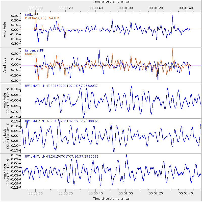
Signal To Noise
| Channel | StoN | STA | LTA |
| UW:UMAT: :HHZ:20150701T07:16:57.258003Z | 0.7686294 | 4.7615025E-8 | 6.1947965E-8 |
| UW:UMAT: :HHN:20150701T07:16:57.258003Z | 0.84252226 | 3.0661052E-8 | 3.6391977E-8 |
| UW:UMAT: :HHE:20150701T07:16:57.258003Z | 2.5862014 | 9.1740006E-8 | 3.5472876E-8 |
| Arrivals |
| Ps | |
| PpPs | |
| PsPs/PpSs | |


