MIAR Mount Ida, Arkansas, USA - Earthquake Result Viewer
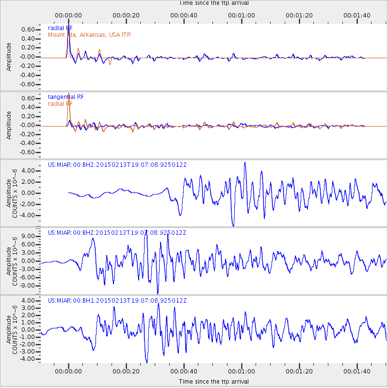
Earthquake location: Northern Mid-Atlantic Ridge
Earthquake latitude/longitude: 52.6/-31.9
Earthquake time(UTC): 2015/02/13 (044) 18:59:12 GMT
Earthquake Depth: 16 km
Earthquake Magnitude: 7.1 MWW, 6.8 MI, 7.0 MWB, 7.0 MWC, 7.1 MWC
Earthquake Catalog/Contributor: NEIC PDE/NEIC COMCAT
Network: US United States National Seismic Network
Station: MIAR Mount Ida, Arkansas, USA
Lat/Lon: 34.55 N/93.58 W
Elevation: 207 m
Distance: 46.7 deg
Az: 272.655 deg
Baz: 47.523 deg
Ray Param: 0.07047819
Estimated Moho Depth: 26.5 km
Estimated Crust Vp/Vs: 1.87
Assumed Crust Vp: 6.498 km/s
Estimated Crust Vs: 3.479 km/s
Estimated Crust Poisson's Ratio: 0.30
Radial Match: 94.680984 %
Radial Bump: 281
Transverse Match: 77.05744 %
Transverse Bump: 400
SOD ConfigId: 872571
Insert Time: 2015-02-27 19:20:23.892 +0000
GWidth: 2.5
Max Bumps: 400
Tol: 0.001

Signal To Noise

ChannelStoNSTALTA
US:MIAR:00:BHZ:20150213T19:07:08.925012Z3.64194851.1735076E-63.2221973E-7
US:MIAR:00:BH1:20150213T19:07:08.925012Z0.634654762.5819634E-74.0682957E-7
US:MIAR:00:BH2:20150213T19:07:08.925012Z1.04237934.5454433E-74.3606428E-7
Arrivals
Ps3.8 SECOND
PpPs11 SECOND
PsPs/PpSs15 SECOND