You are here: Home > Network List > US - United States National Seismic Network Stations List
> Station AMTX Amarillo, Texas, USA > Earthquake Result Viewer
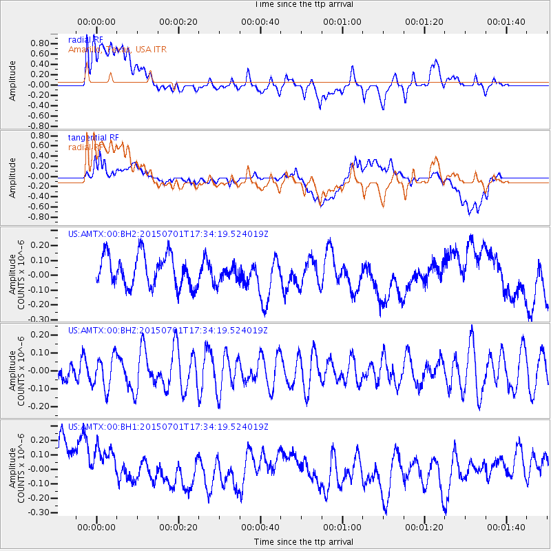
AMTX Amarillo, Texas, USA - Earthquake Result Viewer
*The percent match for this event was below the threshold and hence no stack was calculated.
| Earthquake location: |
Hokkaido, Japan Region |
| Earthquake latitude/longitude: |
43.5/145.8 |
| Earthquake time(UTC): |
2015/07/01 (182) 17:22:50 GMT |
| Earthquake Depth: |
116 km |
| Earthquake Magnitude: |
4.2 mb |
| Earthquake Catalog/Contributor: |
ISC/ISC |
|
| Network: |
US United States National Seismic Network |
| Station: |
AMTX Amarillo, Texas, USA |
| Lat/Lon: |
34.53 N/101.41 W |
| Elevation: |
1010 m |
|
| Distance: |
81.1 deg |
| Az: |
50.415 deg |
| Baz: |
317.254 deg |
| Ray Param: |
$rayparam |
*The percent match for this event was below the threshold and hence was not used in the summary stack. |
|
| Radial Match: |
38.78629 % |
| Radial Bump: |
400 |
| Transverse Match: |
39.81232 % |
| Transverse Bump: |
400 |
| SOD ConfigId: |
7422571 |
| Insert Time: |
2019-04-19 13:45:40.615 +0000 |
| GWidth: |
2.5 |
| Max Bumps: |
400 |
| Tol: |
0.001 |
|
Signal To Noise
| Channel | StoN | STA | LTA |
| US:AMTX:00:BHZ:20150701T17:34:19.524019Z | 1.1474332 | 9.184996E-8 | 8.00482E-8 |
| US:AMTX:00:BH1:20150701T17:34:19.524019Z | 0.8160735 | 2.0071087E-7 | 2.4594706E-7 |
| US:AMTX:00:BH2:20150701T17:34:19.524019Z | 0.52280533 | 5.4798942E-8 | 1.04817104E-7 |
| Arrivals |
| Ps | |
| PpPs | |
| PsPs/PpSs | |


