
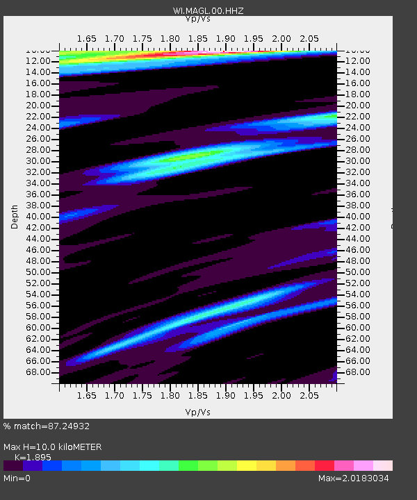
MAGL Barre de l'ile, Saint louis, Marie Galante - Earthquake Result Viewer
| ||||||||||||||||||
| ||||||||||||||||||
| ||||||||||||||||||
|
Signal To Noise
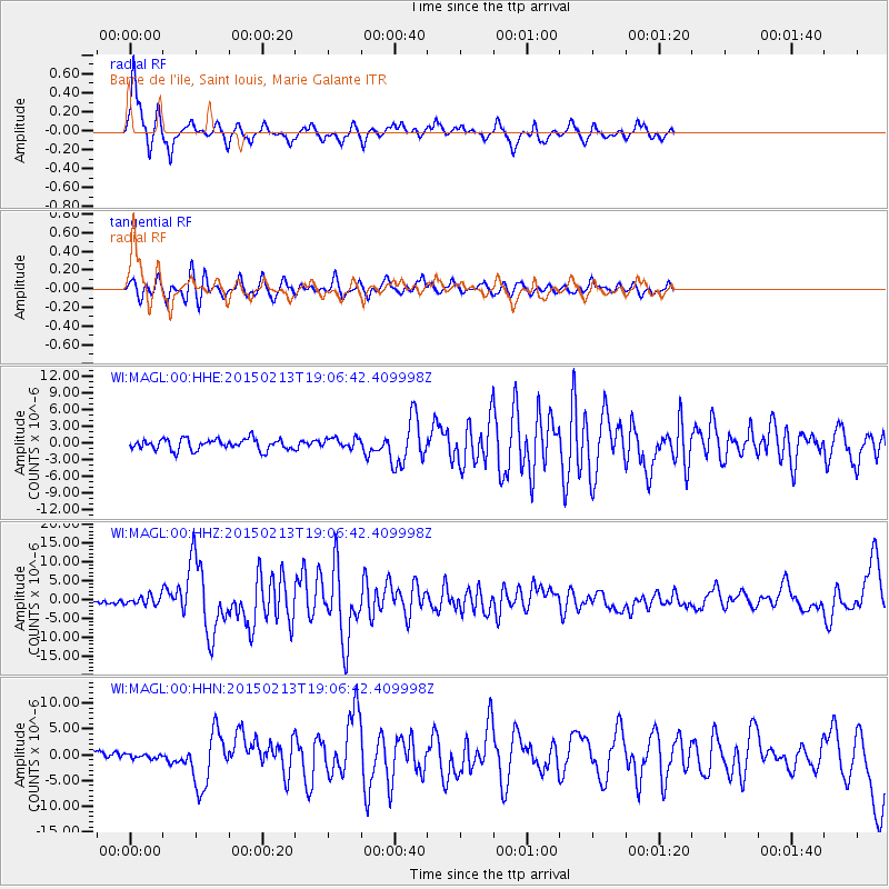
| Channel | StoN | STA | LTA |
| WI:MAGL:00:HHZ:20150213T19:06:42.409998Z | 1.8877859 | 1.1383543E-6 | 6.030102E-7 |
| WI:MAGL:00:HHN:20150213T19:06:42.409998Z | 0.49185142 | 4.28683E-7 | 8.715701E-7 |
| WI:MAGL:00:HHE:20150213T19:06:42.409998Z | 0.9589274 | 9.380929E-7 | 9.782732E-7 |
| Arrivals | |
| Ps | 1.6 SECOND |
| PpPs | 4.7 SECOND |
| PsPs/PpSs | 6.3 SECOND |

