You are here: Home > Network List > TA - USArray Transportable Network (new EarthScope stations) Stations List
> Station A36M Sachs Harbour, NT, CAN > Earthquake Result Viewer
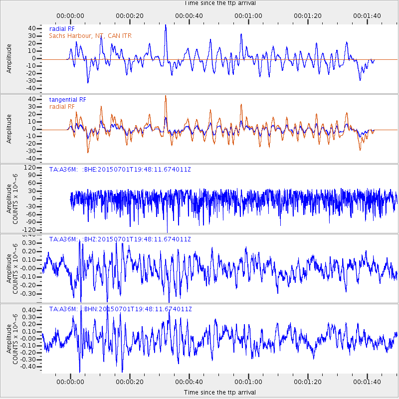
A36M Sachs Harbour, NT, CAN - Earthquake Result Viewer
*The percent match for this event was below the threshold and hence no stack was calculated.
| Earthquake location: |
Solomon Islands |
| Earthquake latitude/longitude: |
-11.0/162.6 |
| Earthquake time(UTC): |
2015/07/01 (182) 19:35:21 GMT |
| Earthquake Depth: |
8.9 km |
| Earthquake Magnitude: |
5.8 MO |
| Earthquake Catalog/Contributor: |
NEIC PDE/NEIC ALERT |
|
| Network: |
TA USArray Transportable Network (new EarthScope stations) |
| Station: |
A36M Sachs Harbour, NT, CAN |
| Lat/Lon: |
71.99 N/125.25 W |
| Elevation: |
32 m |
|
| Distance: |
95.0 deg |
| Az: |
17.297 deg |
| Baz: |
249.778 deg |
| Ray Param: |
$rayparam |
*The percent match for this event was below the threshold and hence was not used in the summary stack. |
|
| Radial Match: |
52.621273 % |
| Radial Bump: |
400 |
| Transverse Match: |
52.740196 % |
| Transverse Bump: |
400 |
| SOD ConfigId: |
7422571 |
| Insert Time: |
2019-04-19 13:55:44.712 +0000 |
| GWidth: |
2.5 |
| Max Bumps: |
400 |
| Tol: |
0.001 |
|
Signal To Noise
| Channel | StoN | STA | LTA |
| TA:A36M: :BHZ:20150701T19:48:11.674011Z | 2.8863838 | 1.8858479E-7 | 6.533601E-8 |
| TA:A36M: :BHN:20150701T19:48:11.674011Z | 2.2896707 | 1.9075392E-7 | 8.331064E-8 |
| TA:A36M: :BHE:20150701T19:48:11.674011Z | 1.1433678 | 3.0499206E-5 | 2.6674887E-5 |
| Arrivals |
| Ps | |
| PpPs | |
| PsPs/PpSs | |


